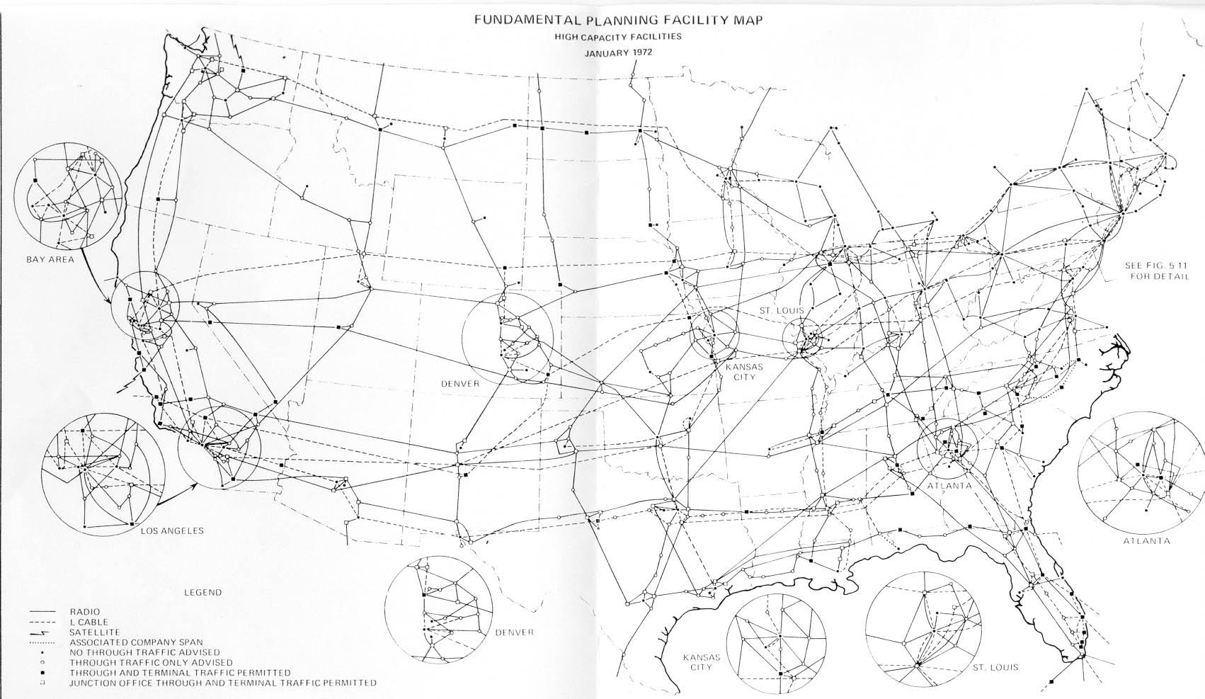
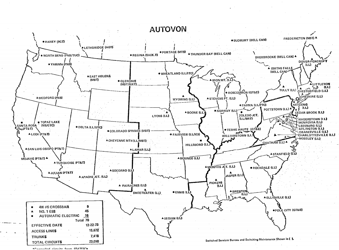
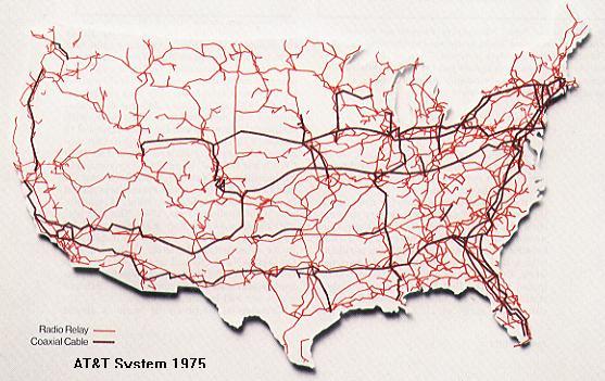
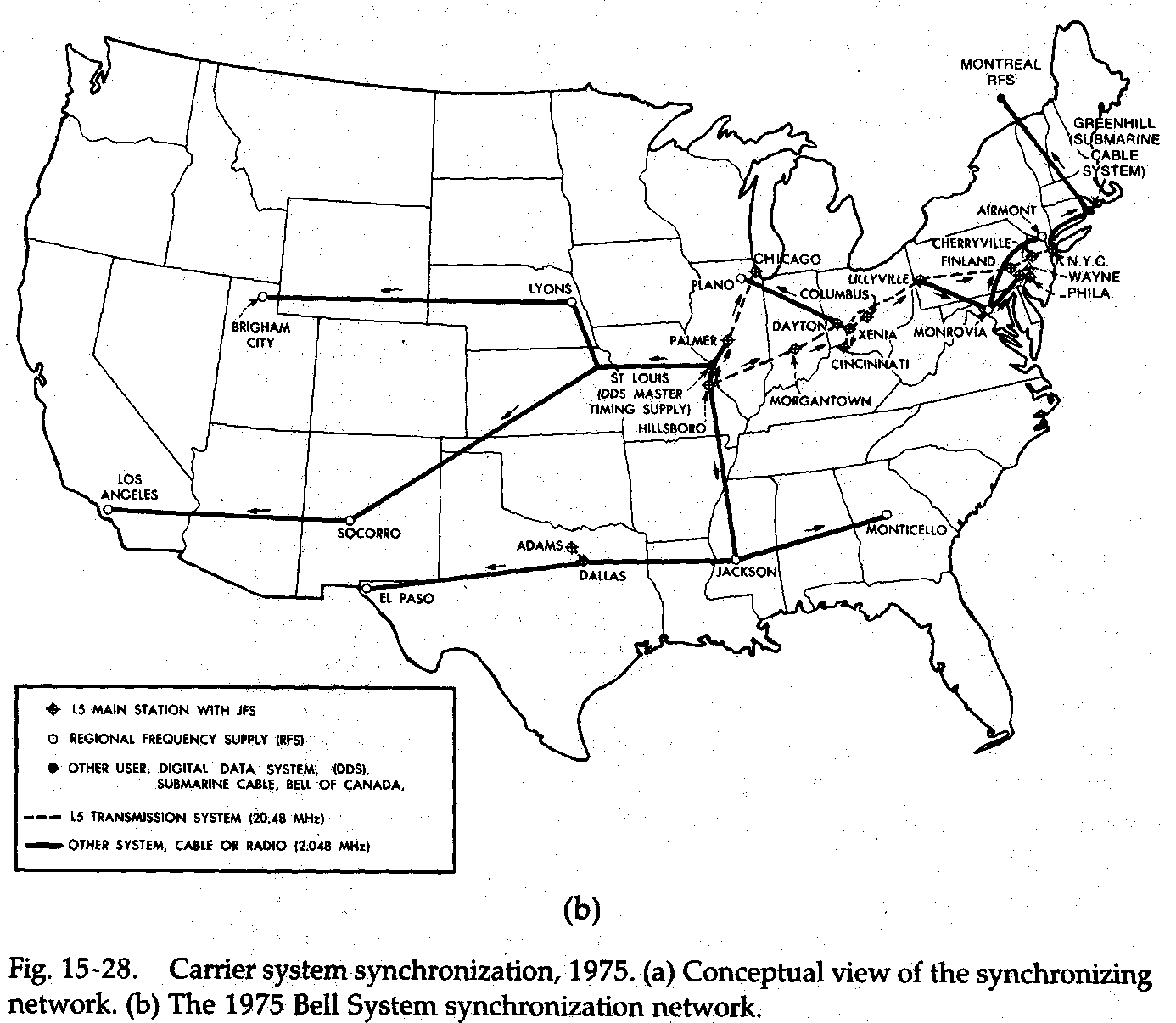
Maps
Here you will find a collection of historic maps of telephone and telecommunications lines. They are collected from various sources, many of which were already secondhand collections—so a source is noted when possible, but it's hard to be 100% certain where these all came from. The maps are presented by the year they were created and the name shown on the map, when possible. The M# is a TD-2 Control Number, a scheme invented just to make it a little easier to refer to specific maps when they come up in different places online. The Authority column contains any source markings from the map itself, typically date published and sometimes a drawing number.
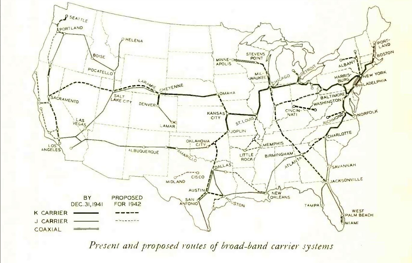
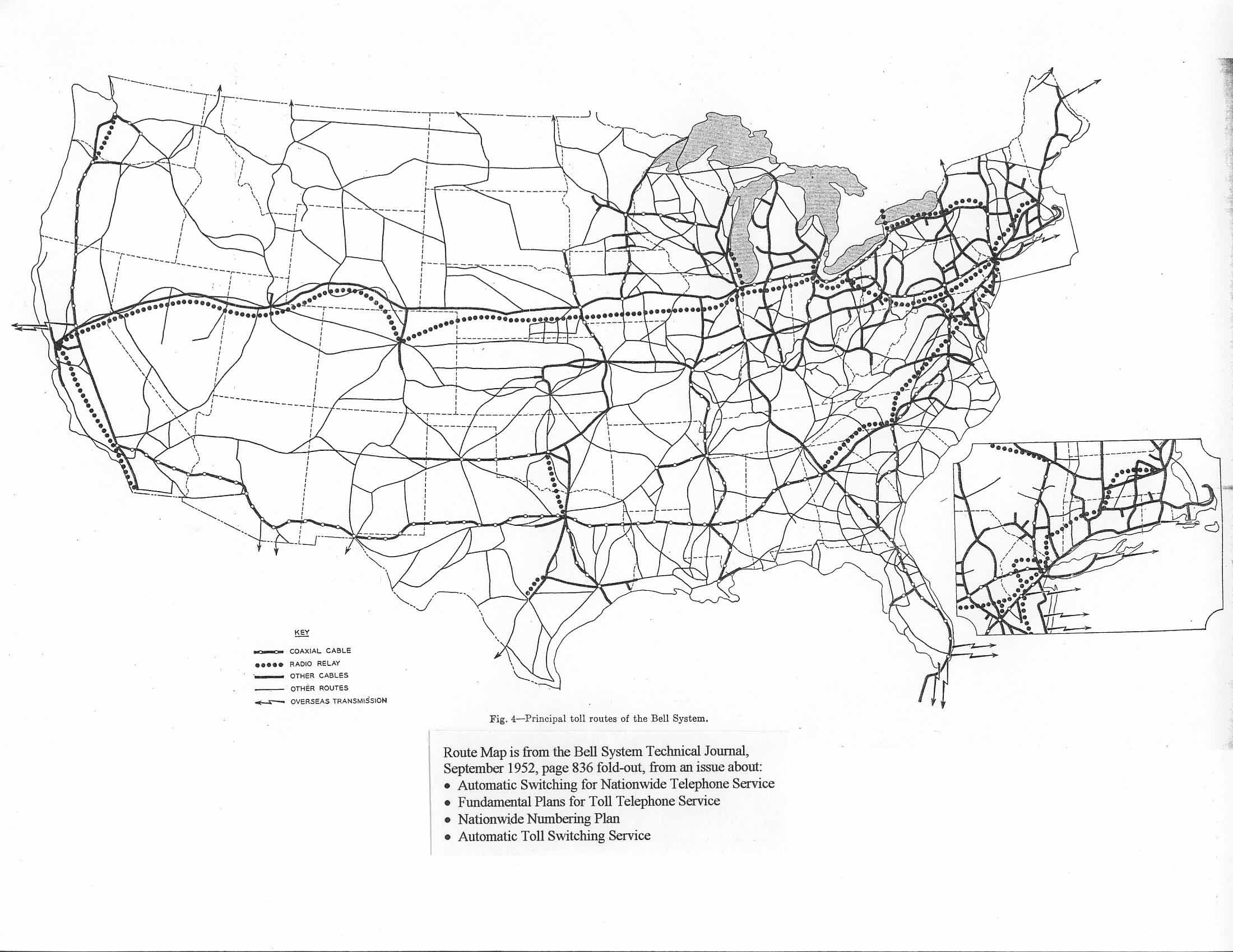
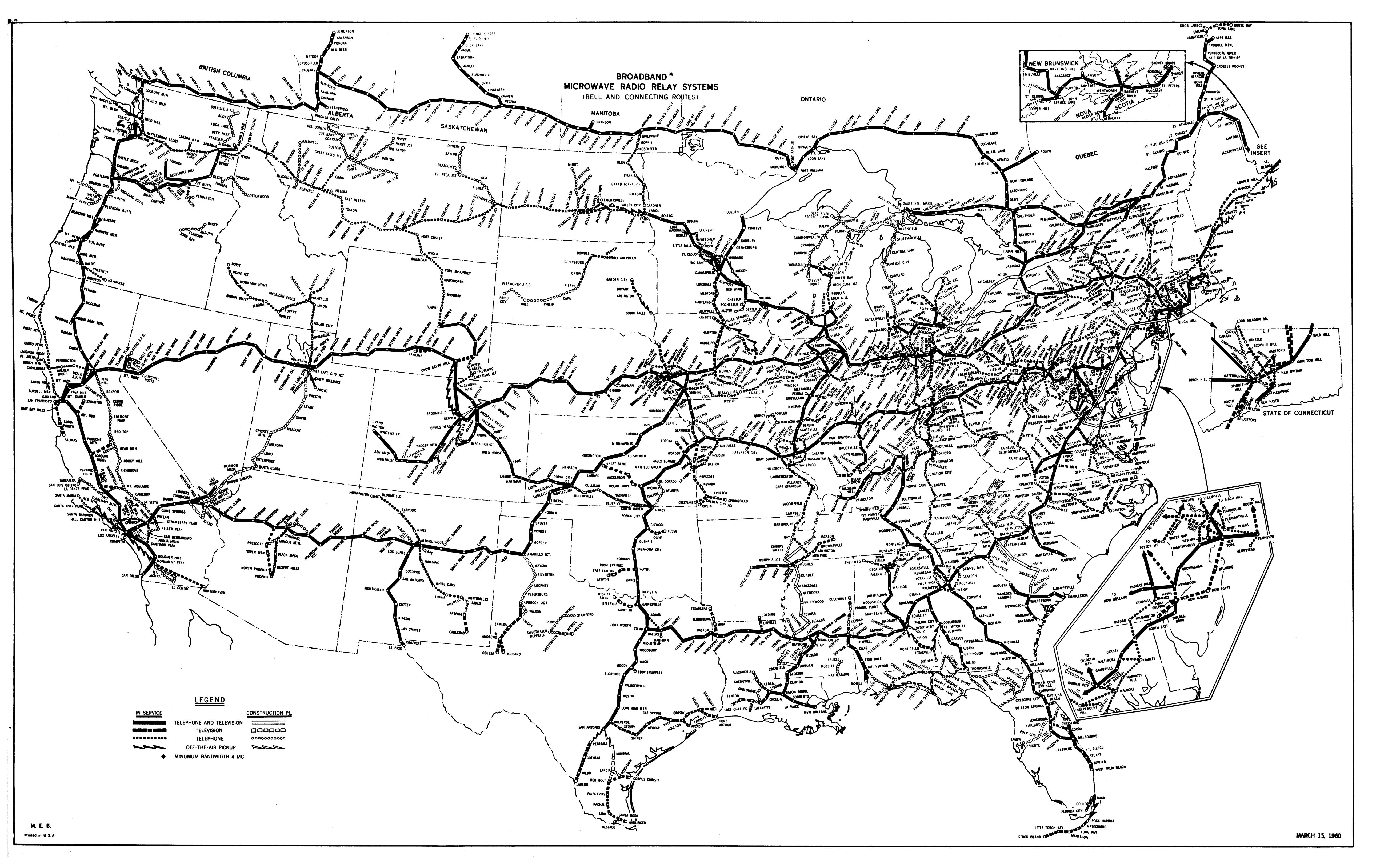
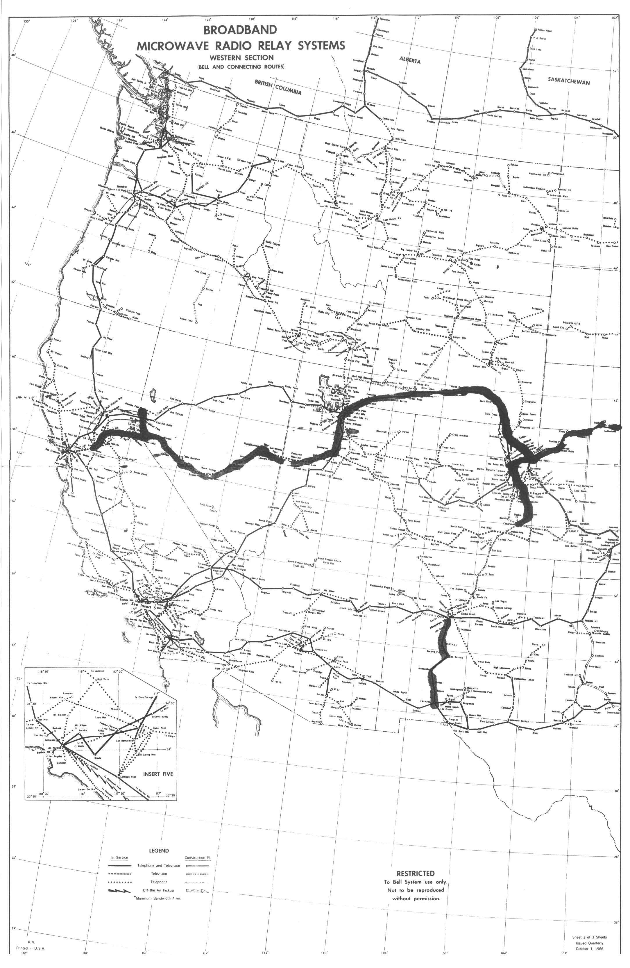
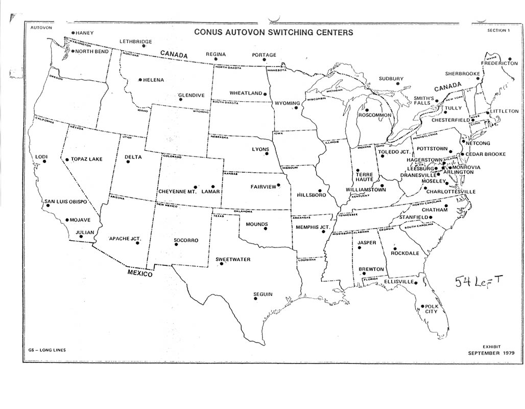
Long Lines System Maps
Regional Maps
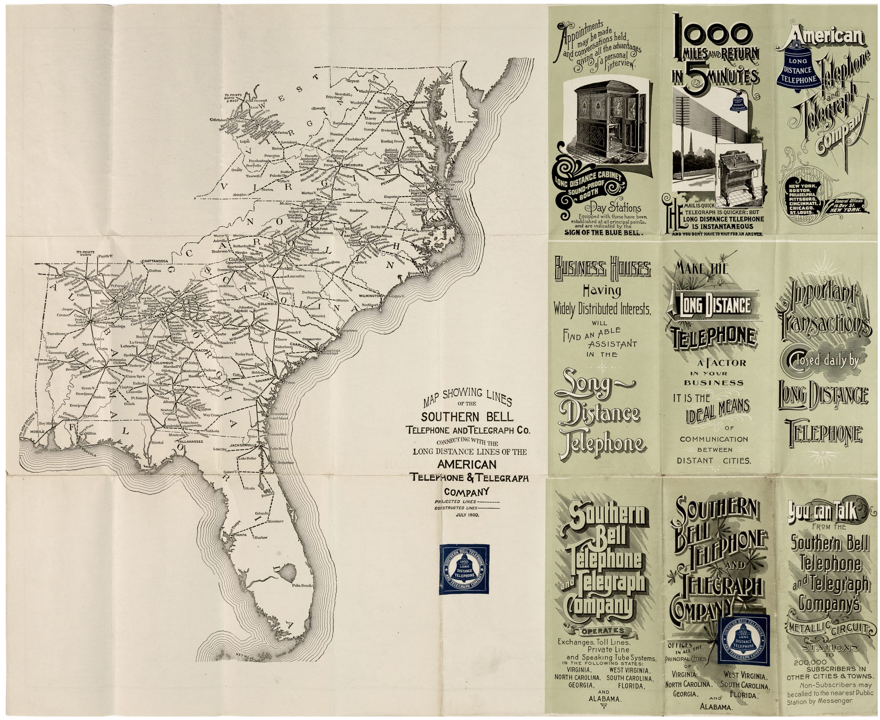
East Coast
| Year | Map | M# | Authority | Source | Notes |
|---|---|---|---|---|---|
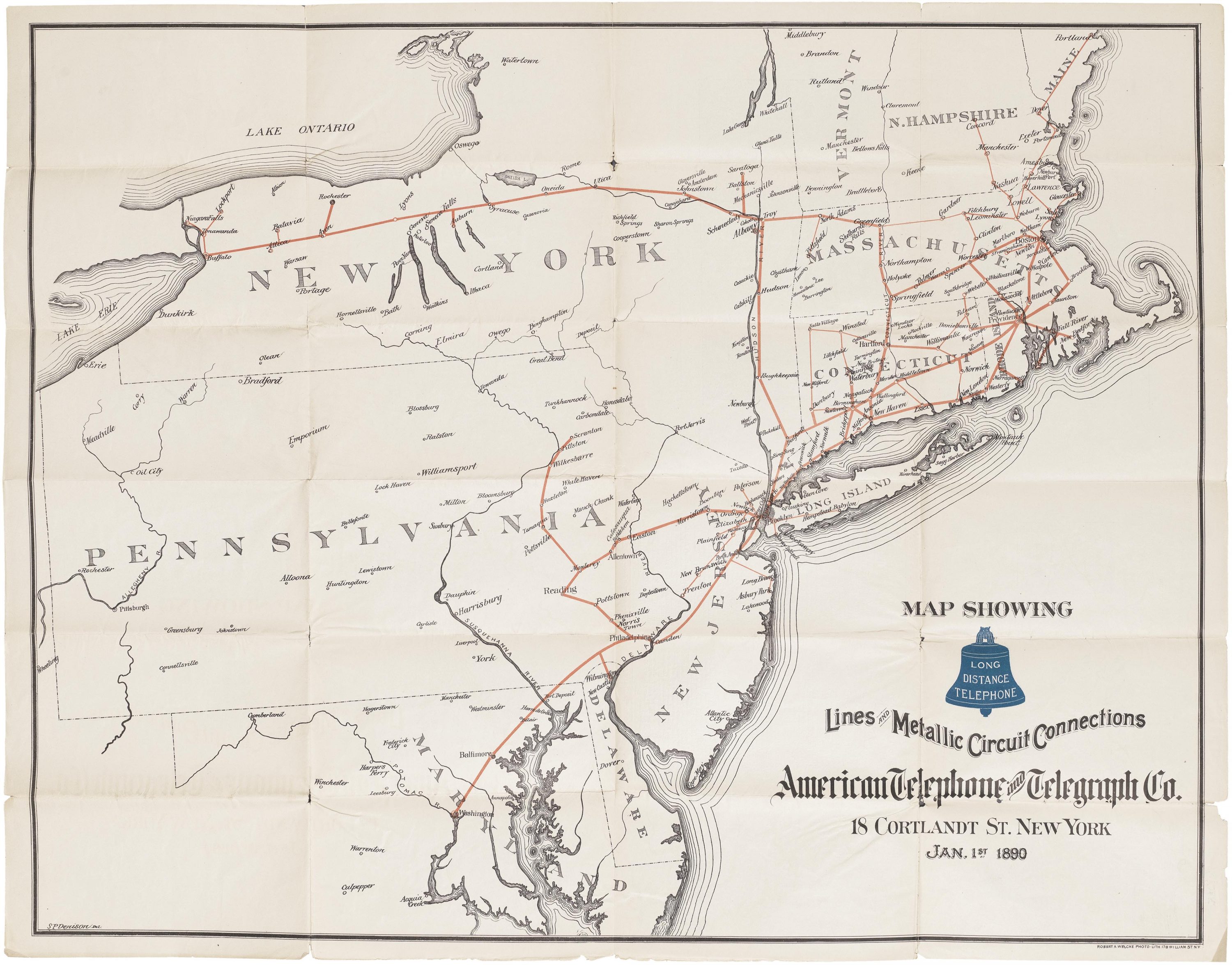
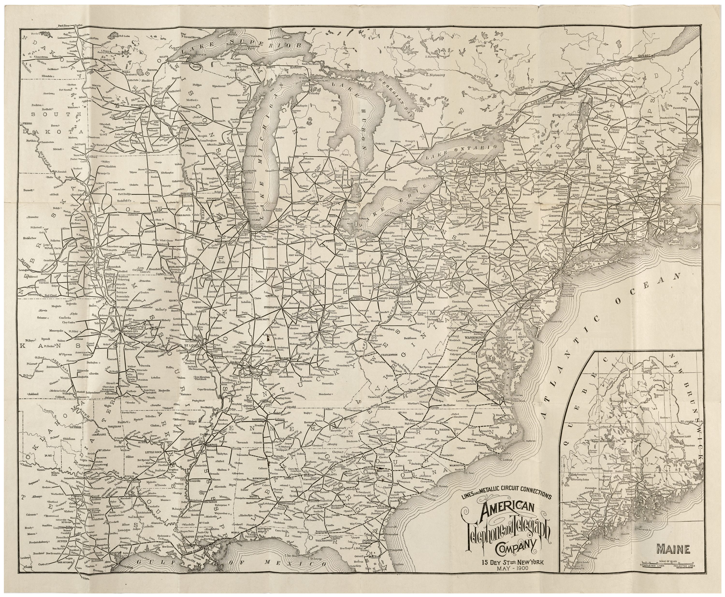
| 1900 | Southern Bell and Interconnecting Long Lines | M21 | Jul. 1900 | ||
| 1969 | Green Hill - Cheshire "A" Cable Route Map | M13 | via WEPBX | Depicts route of the TAT5 transcontinental cable in the coast area |
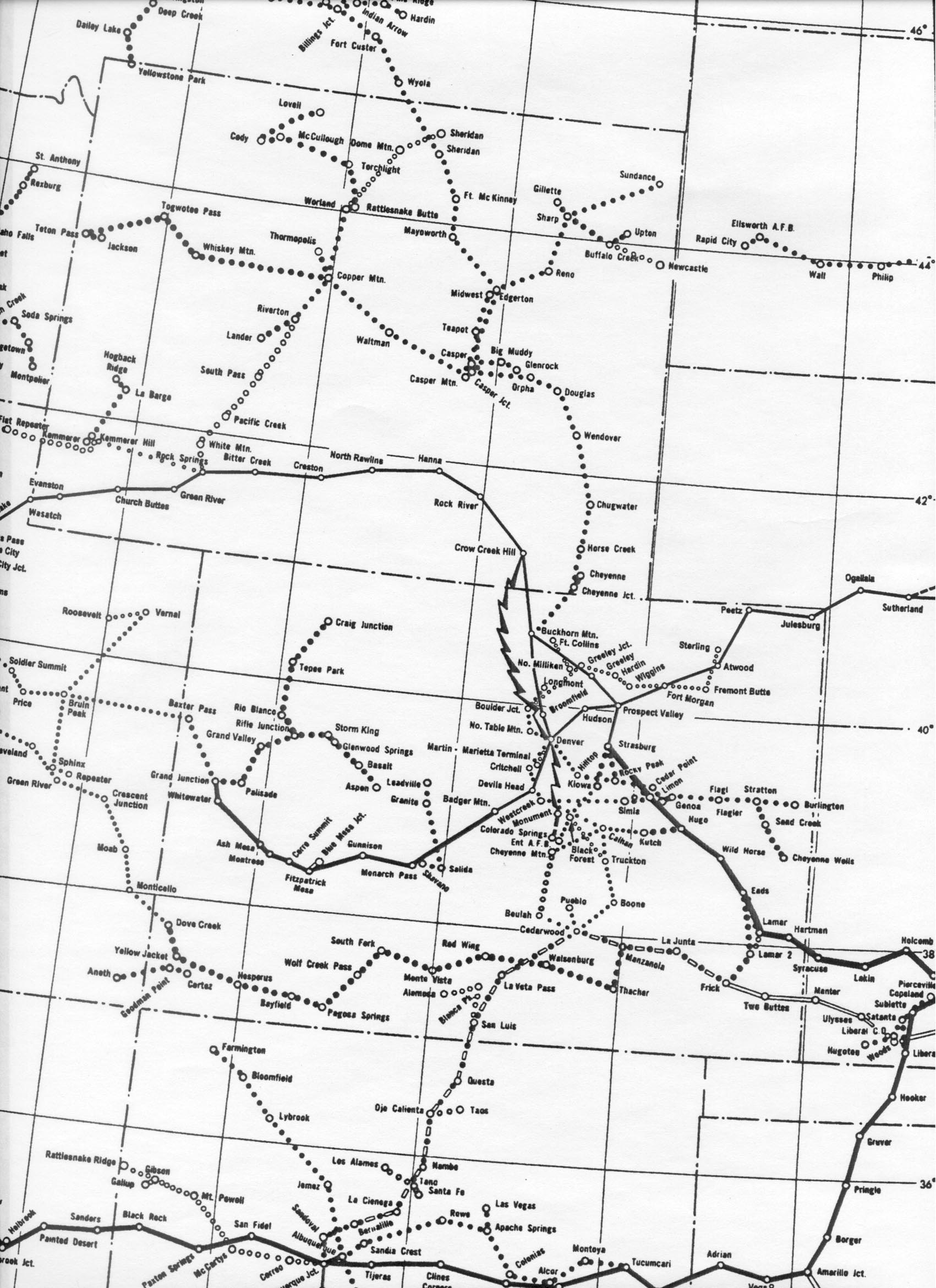
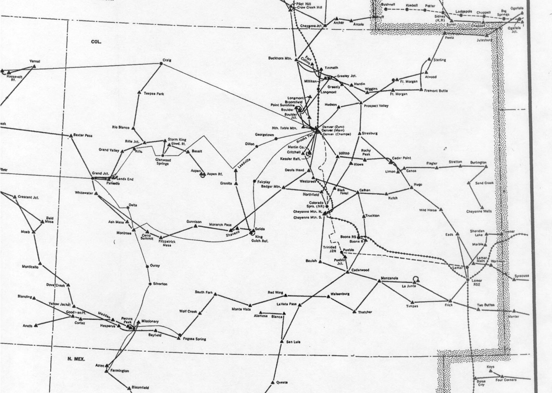
Mountain States
| Year | Map | M# | Authority | Source | Notes |
|---|---|---|---|---|---|
| 1966 | "MW6610-W-1" microwave routes in the Rocky Mountain region | M11 | Via Albert LaFrance/long-lines.net | ||
| 1976 | Colorado section of "Routes of American Telephone and Telegraph Company / Western Area" | M12 | Via Albert LaFrance/long-lines.net | ||
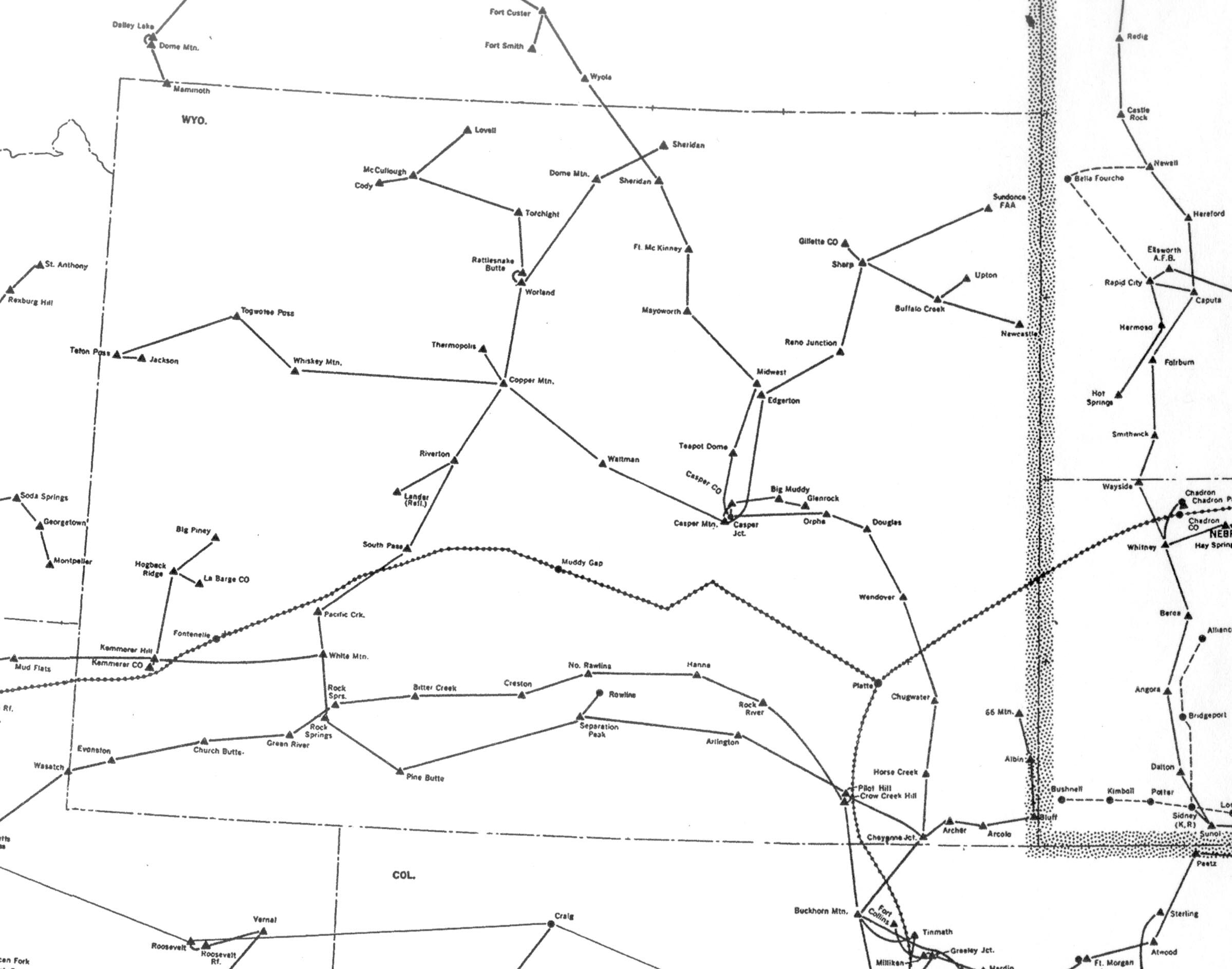
| 1976 | Wyoming microwave map | M24 |
West Coast
| Year | Map | M# | Authority | Source | Notes |
|---|---|---|---|---|---|
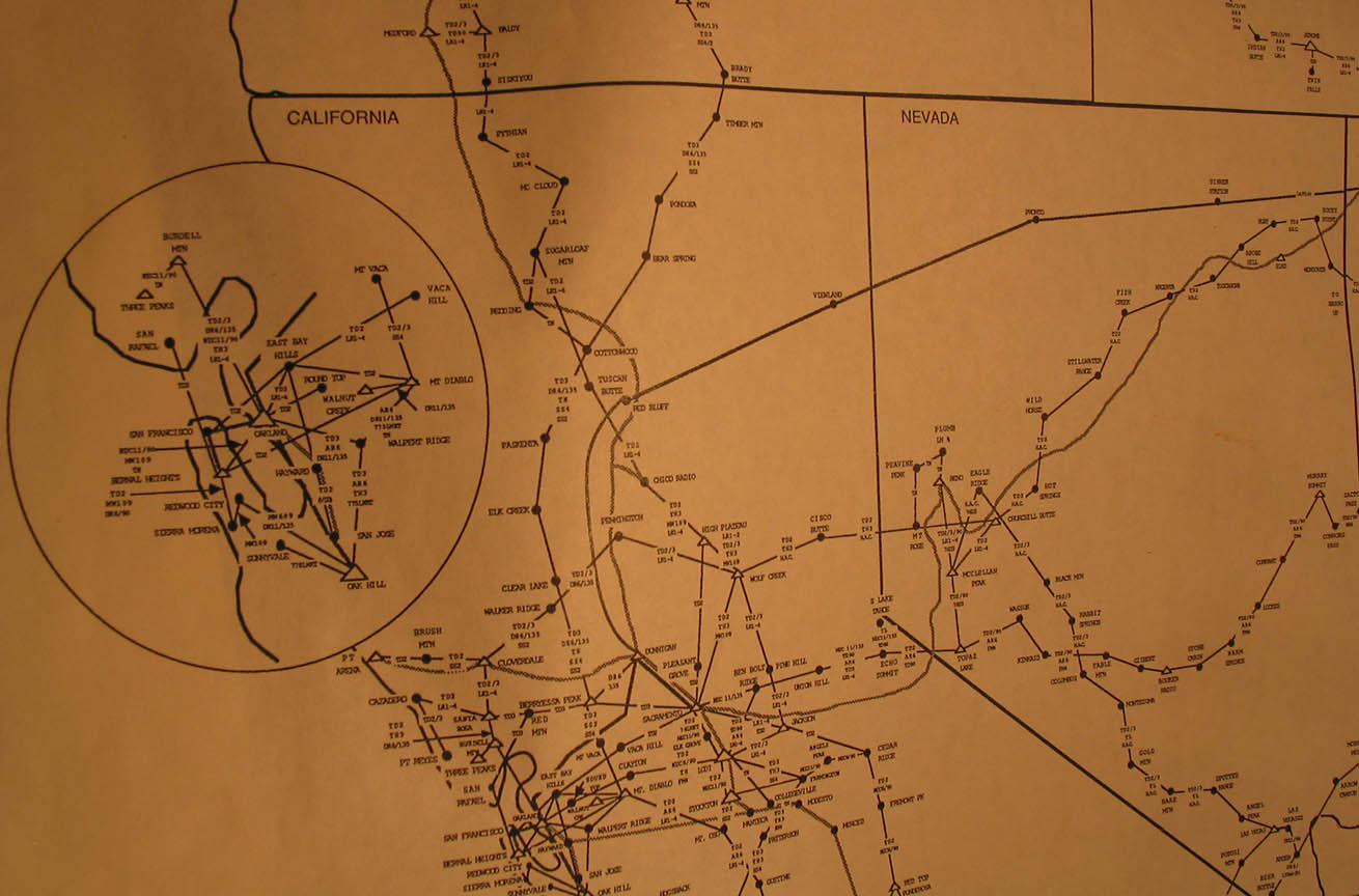
| 1987 | Northern California | M22 | |||
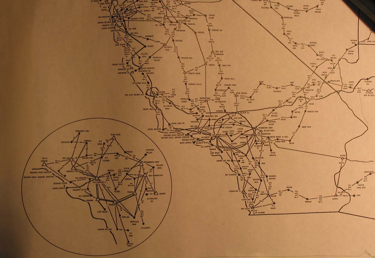
| 1987 | Southern California | M23 |