This is an old revision of the document!
Maps
Here you will find a collection of historic maps of telephone and telecommunications lines. They are collected from various sources, many of which were already secondhand collections—so a source is noted when possible, but it's hard to be 100% certain where these all came from. The maps are presented by the year they were created and the name shown on the map, when possible. The number in brackets is a TD-2 Control Number, a scheme invented just to make it a little easier to refer to specific maps when they come up in different places online.
Long Lines System Maps
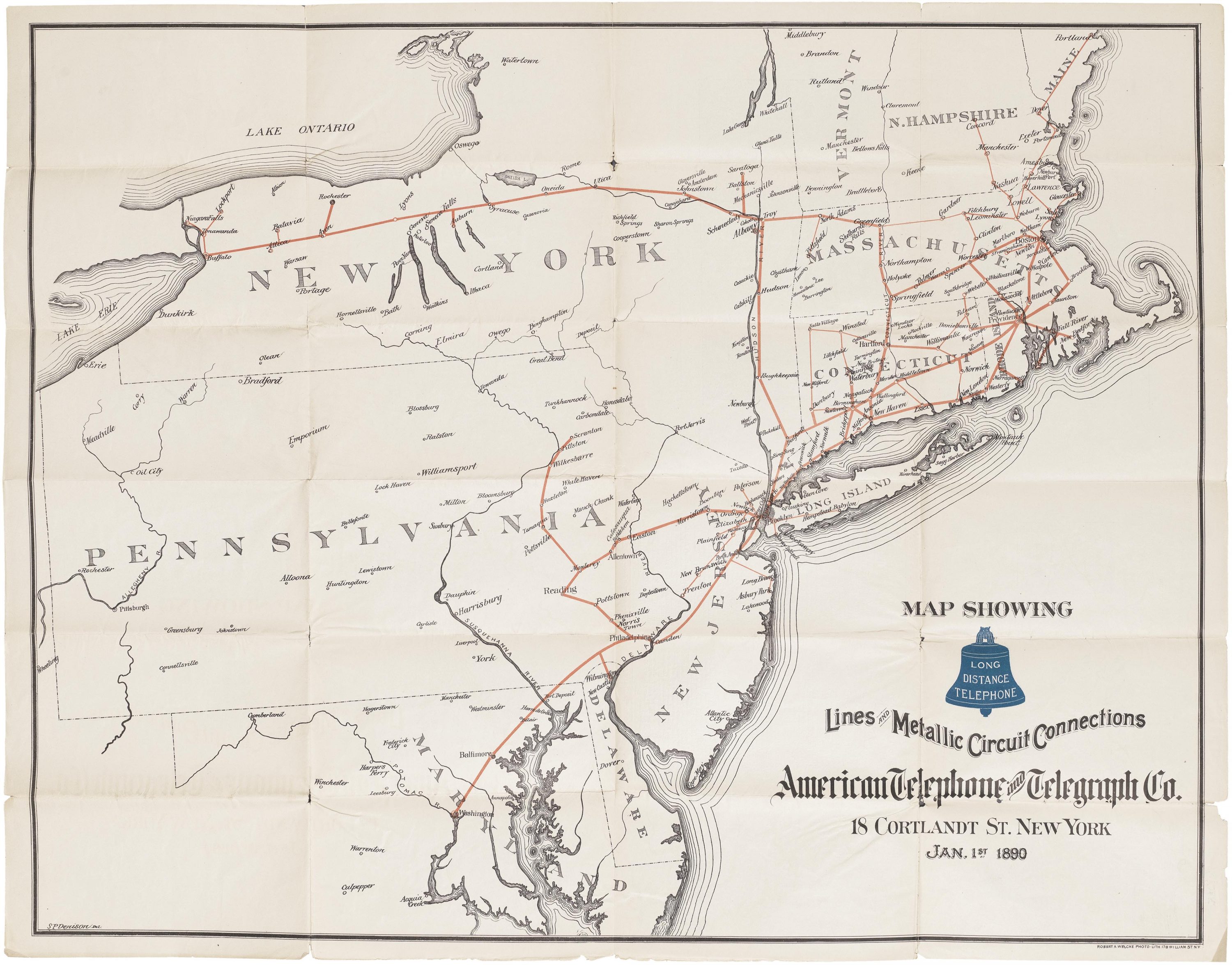
- [M19] 1890: Lines and Metallic Circuit Connections (via Telecom Archaeology) [Jan. 1 1890]
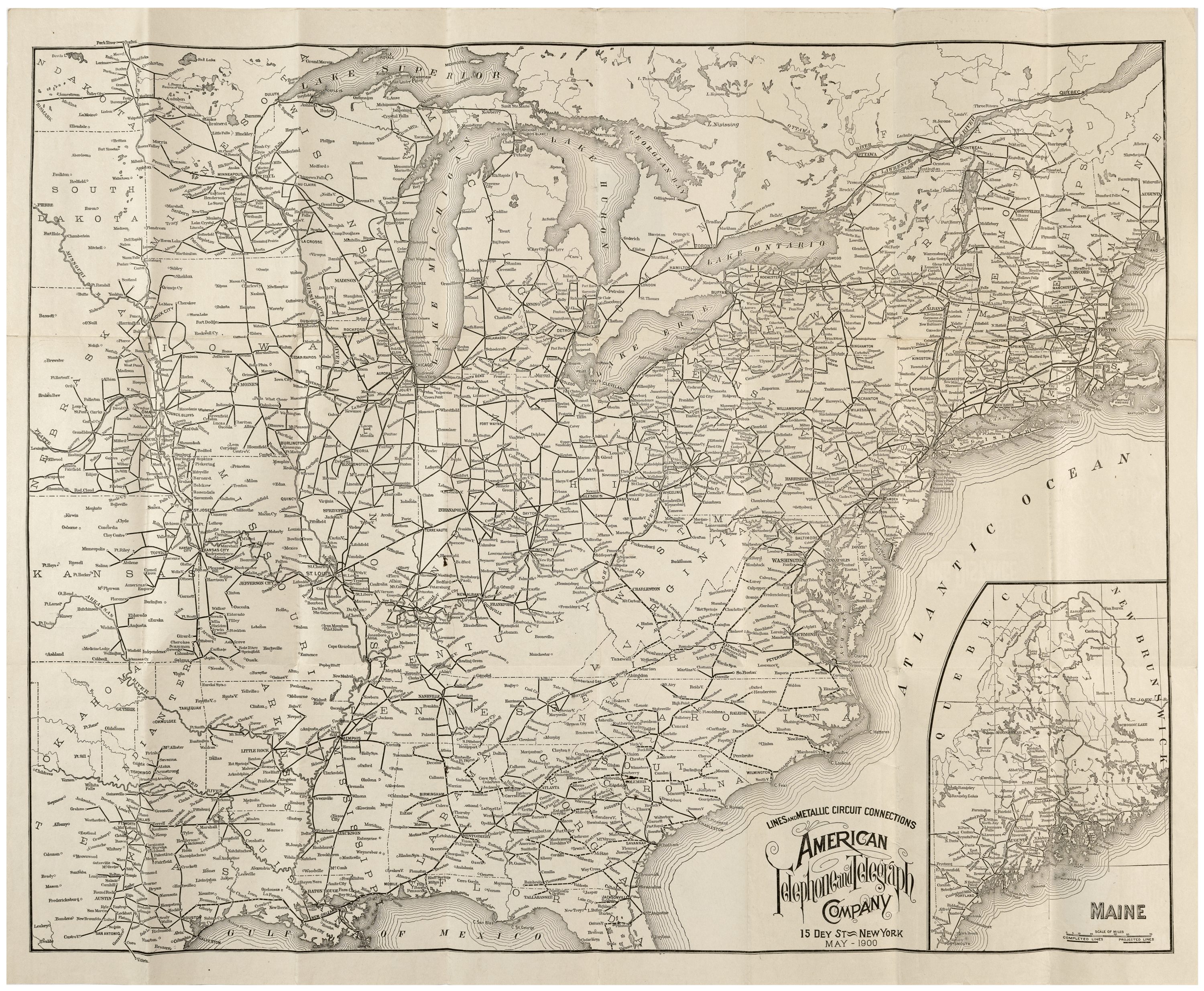
- [M20] 1900: Lines and Metallic Circuit Connections (via Telecom Archaeology) [May 1900]
- [M14] 1909: Lines of the Bell Telephone Companies (via Telecom Archaeology) [Jul. 1 1909]
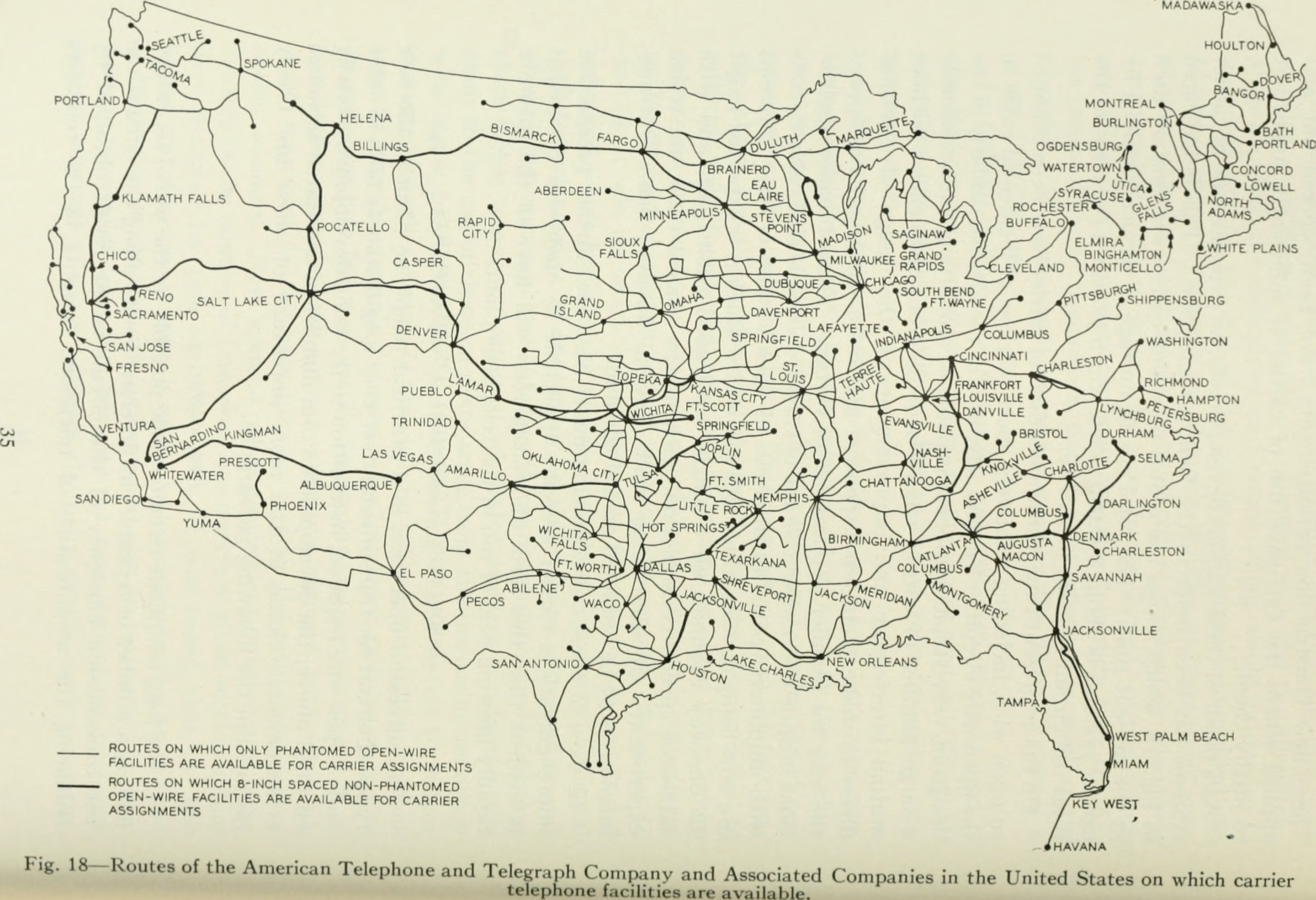
- [M21] 1922: Routes of the American Telephone and Telegraph Company and Associated Companies (via Telecom Archaeology)
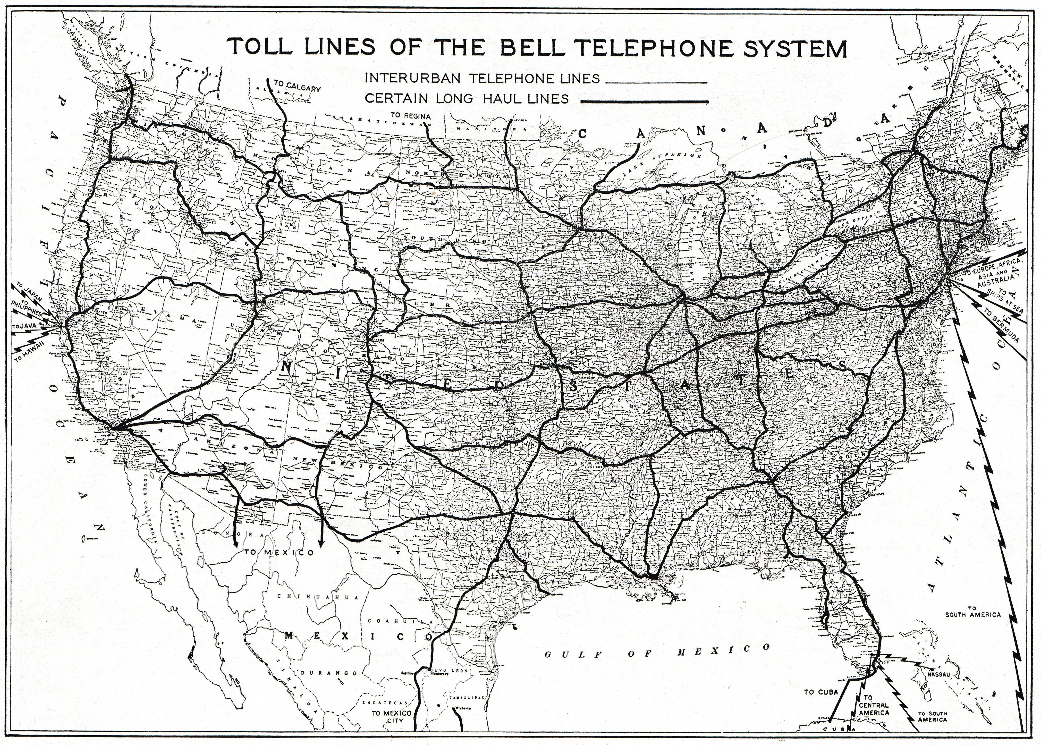
- [M17] 1936: Toll Lines of the Bell Telephone System (via Telecom Archaeology)
- [M1] 1941: Routes of American Telephone and Telegraph Company, Long Lines Department (via Telecom Archaeology) [Jan. 1 1941]
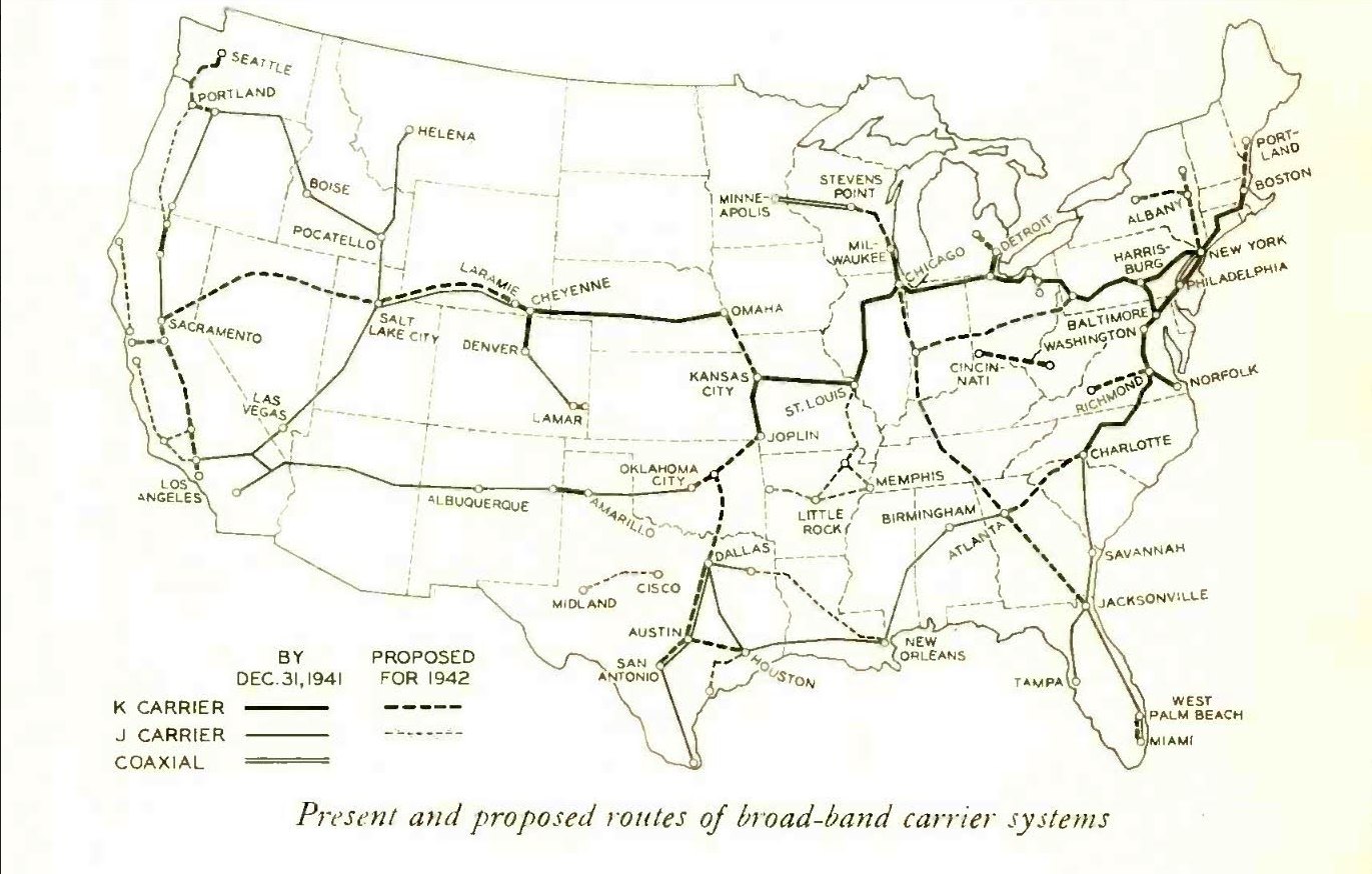
- [M2] 1941: Present and Proposed Routes of Broad Band Carrier Systems [Dec. 31 1941]
- [M15] 1948: Routes of American Telephone and Telegraph Company, Long Lines Department (via Telecom Archaeology) [Jun. 1 1948]
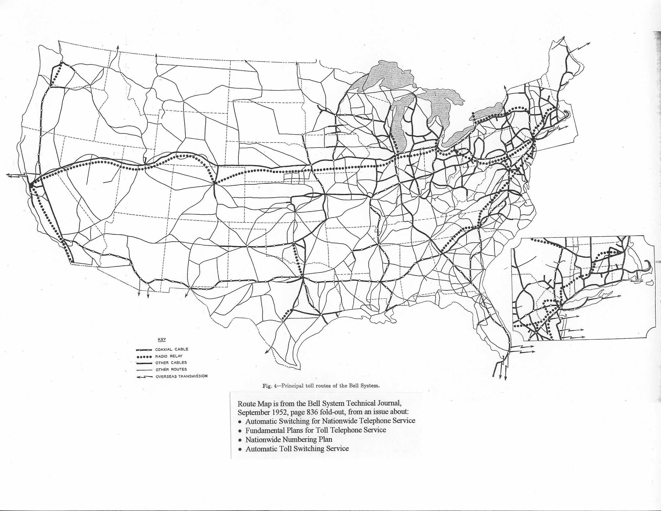
- [M3] 1952: Principal toll routes of the Bell System [BSTJ Sep. 1952 p 836]
- [M16] 1955: Routes of American Telephone and Telegraph Company, Long Lines Department (via Telecom Archaeology) [Dwg. No. 23414-33 Jan. 1955]
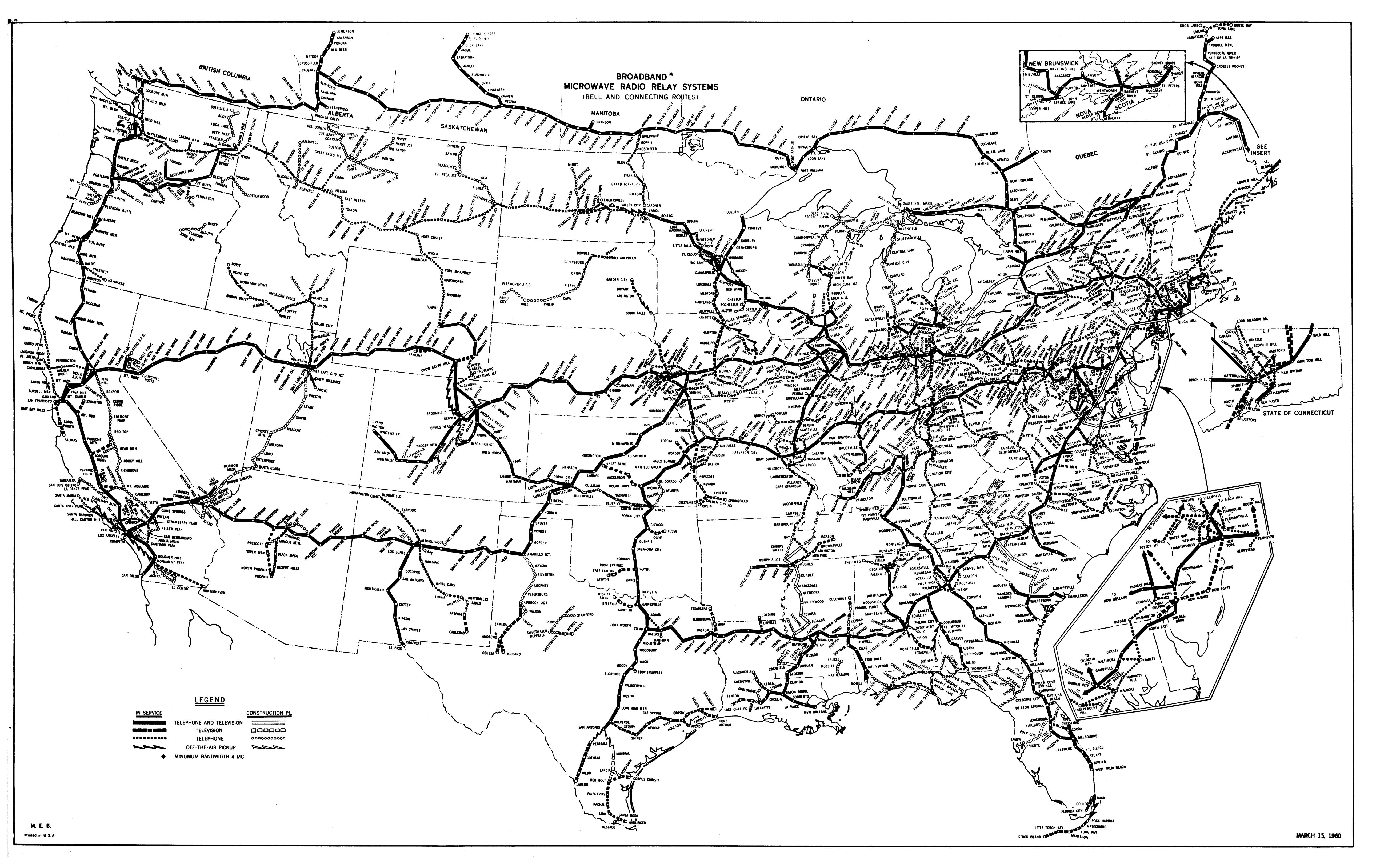
- [M4] 1960: Broadband Microwave Radio Relay Systems (Bell and Connecting Routes) [Mar. 15 1960]
- [M17] 1960: Major Communication Lines of the Long Lines Department (via Telecom Archaology) [Jun. 1960]
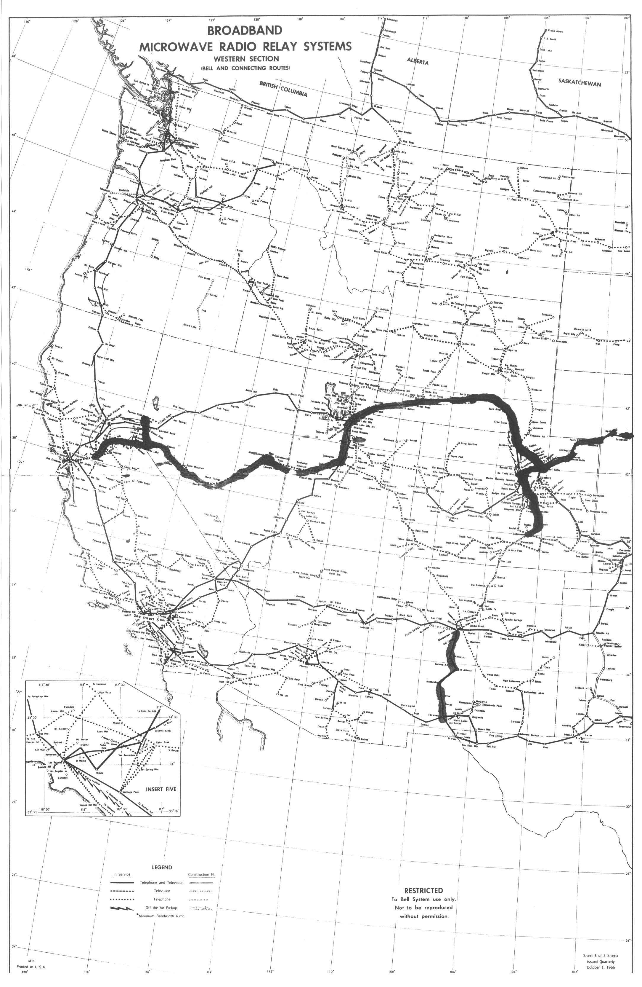
- [M5] 1966: Broadband Microwave Radio Relay Systems, Western Section (Bell and Connecting Routes) [Oct. 1 1966, sheet 3 of 3 - do you have other sheets?]
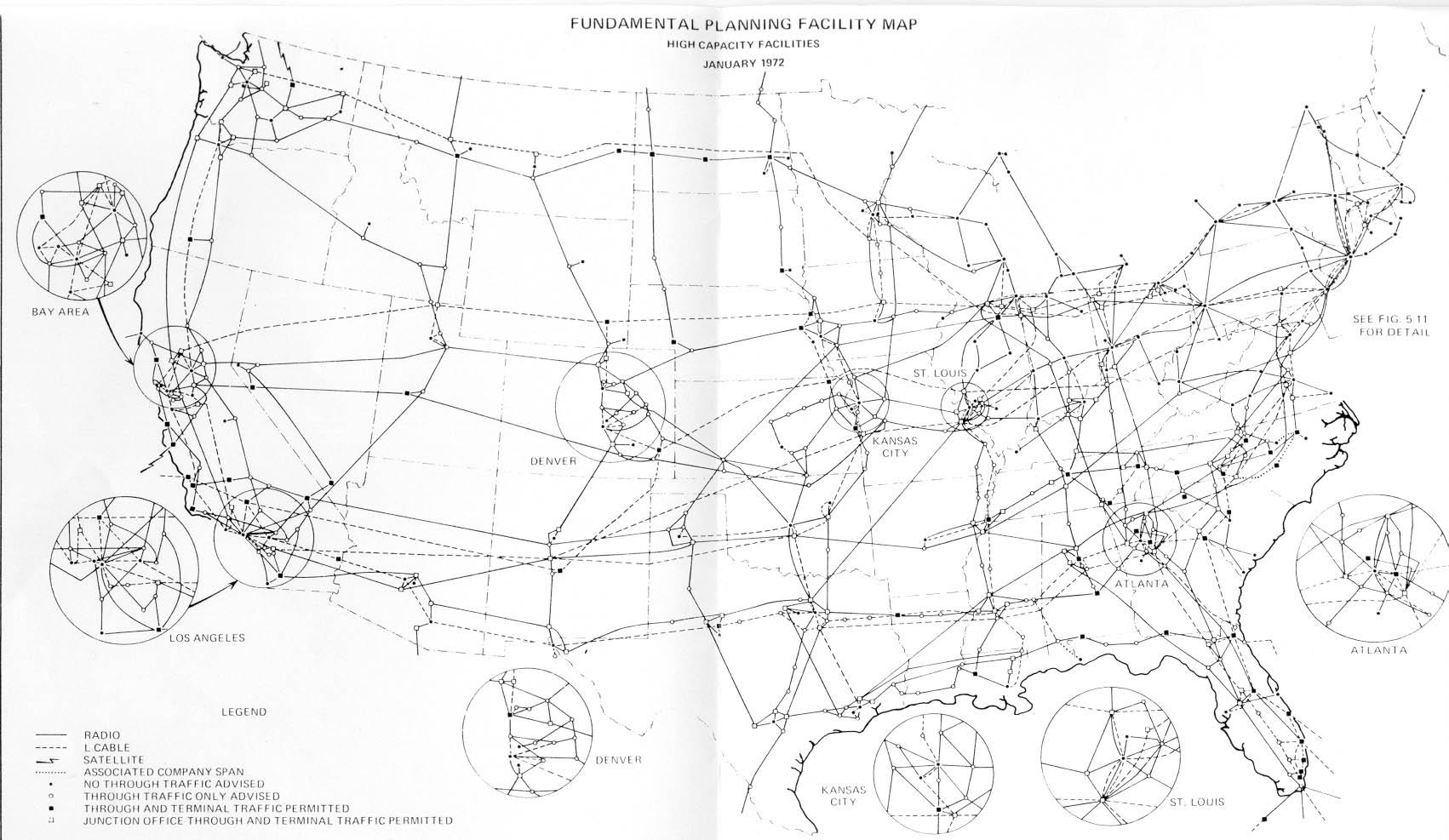
- [M6] 1972: Fundamental Planning Facility Map, High Capacity Facilities [Jan. 1972]
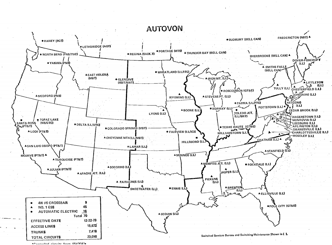
- [M7] 1973: AUTOVON (showing AUTOVON exchange names and types)
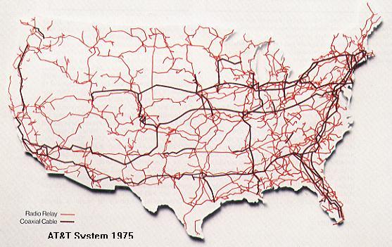
- [M8] 1975: AT&T System 1975 (very little detail but shows some useful routes)
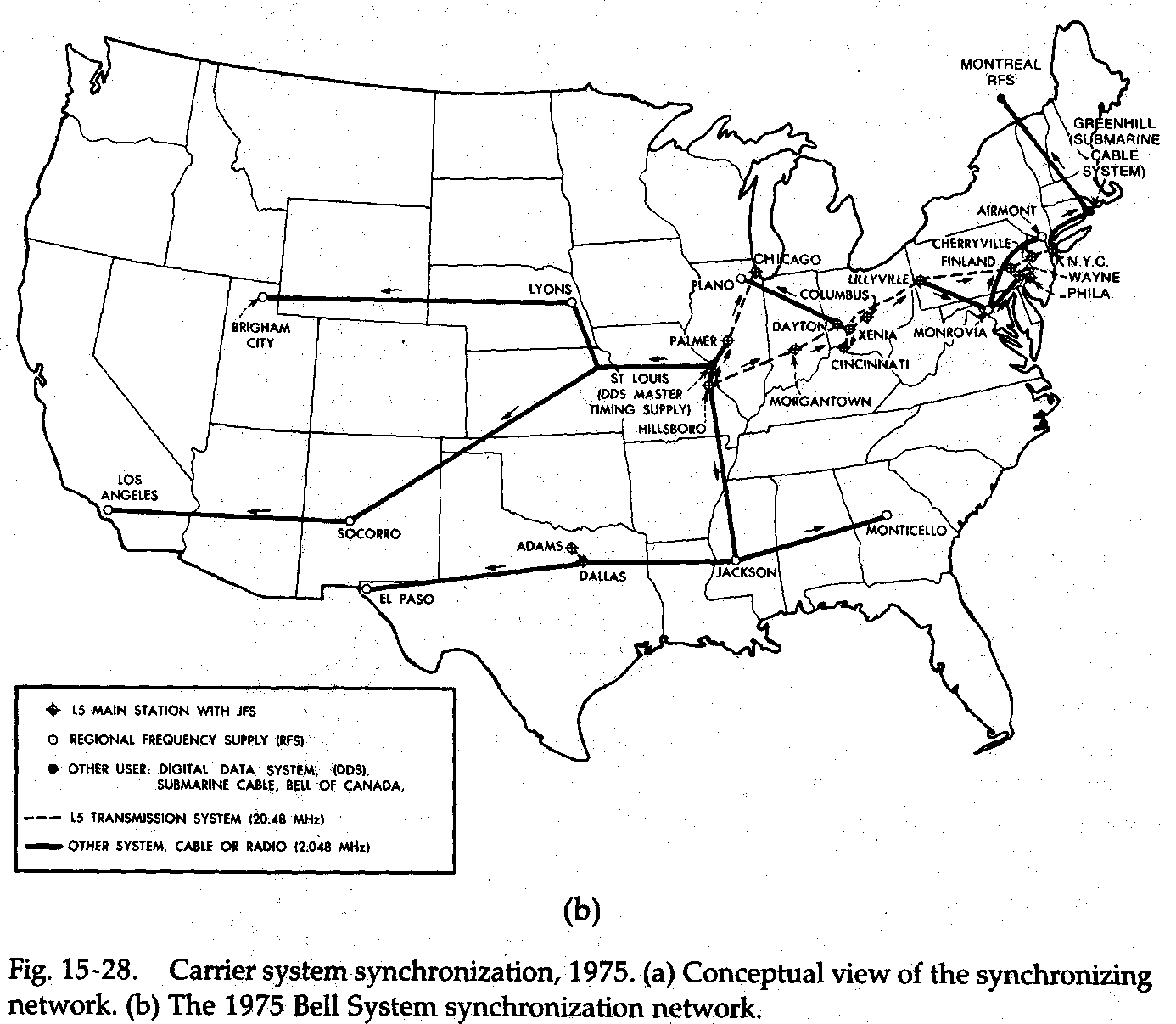
- [M9] 1975: Carrier System Synchronization (showing L5 and “other system” synchronization signal distribution)
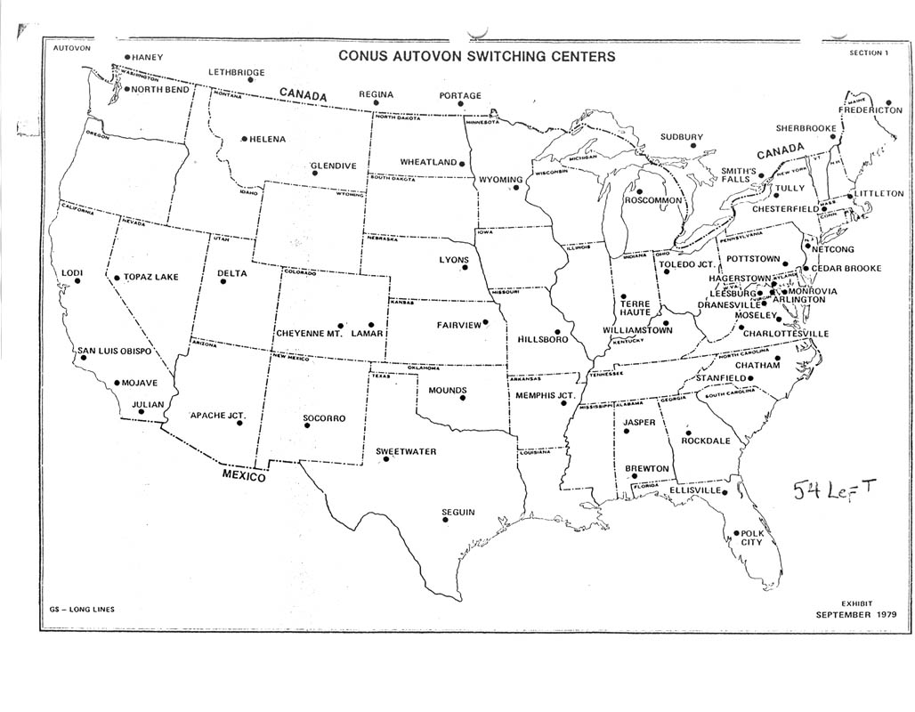
- [M10] 1979: CONUS AUTOVON Switching Centers [Sep. 1979]
- [M18] 1979: Routes of American Telephone and Telegraph Company (via Telecom Archaeology)
Regional Maps
East Coast
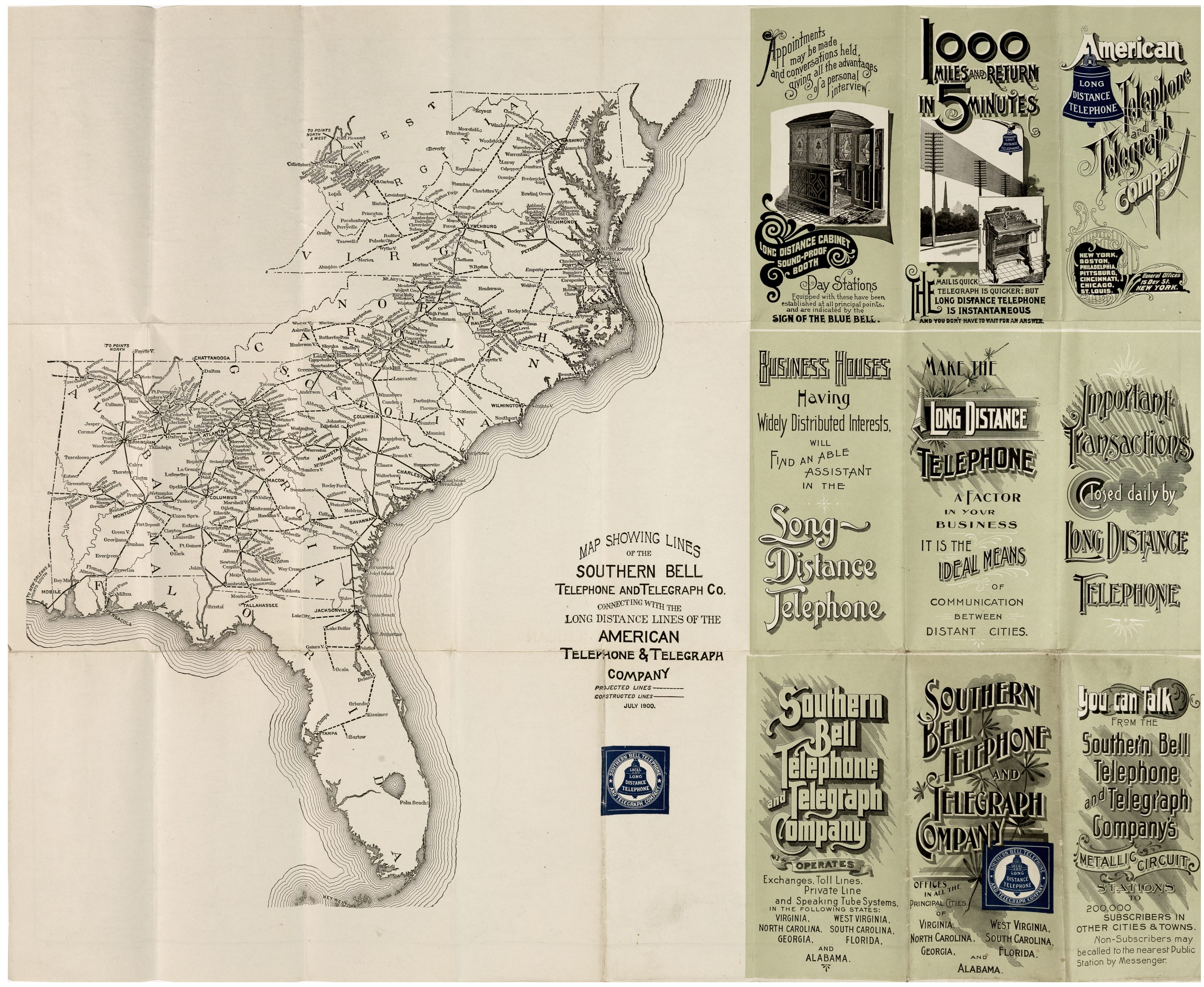
- [M21] 1900: Southern Bell and Interconnecting Long Lines [Jul. 1900]
- [M13] 1969: Green Hill - Cheshire "A" Cable Route Map. Depicts route of the TAT5 transcontinental cable in the coast area. (via WEPBX)
Mountain States
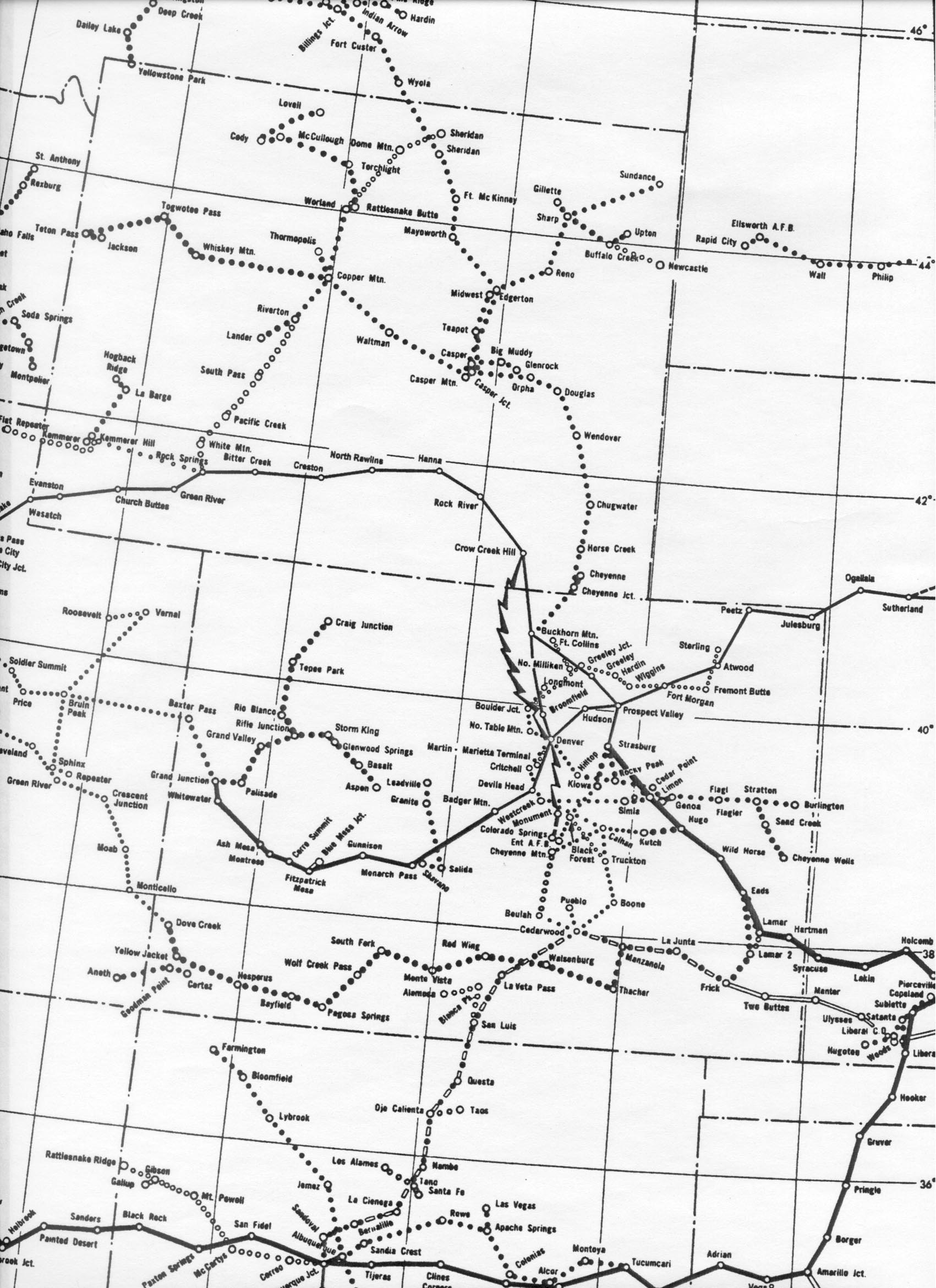
- [M11] 1966: "MW6610-W-1" microwave routes in the Rocky Mountain region. Via Albert LaFrance/long-lines.net.
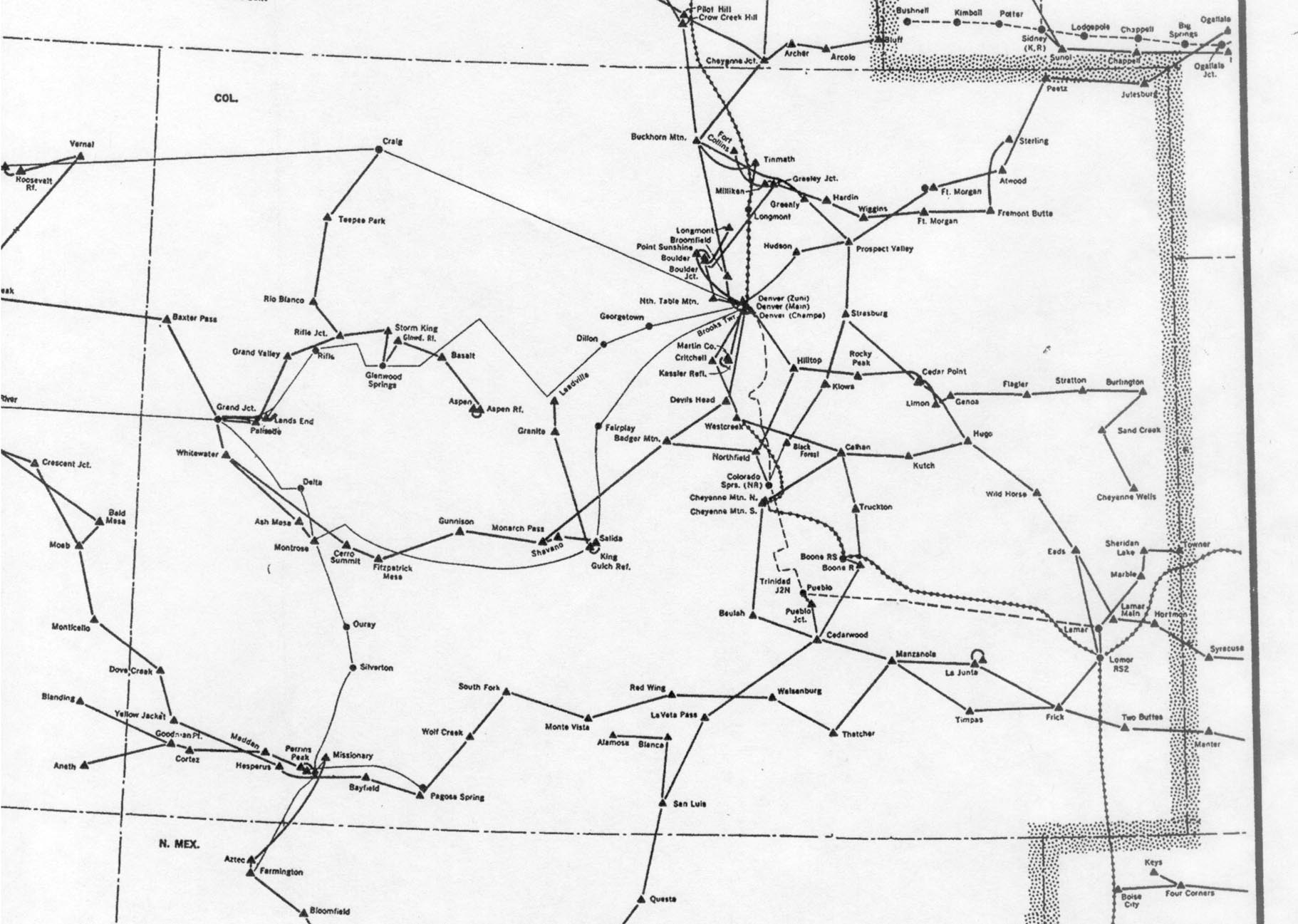
- [M12] 1976: Colorado section of "Routes of American Telephone and Telegraph Company / Western Area". Via Albert LaFrance/long-lines.net.
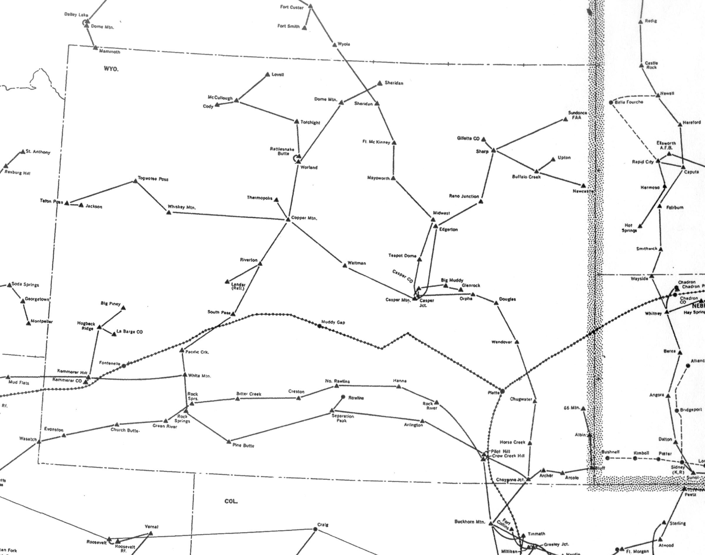
- [M24] 1976: Wyoming microwave map
West Coast
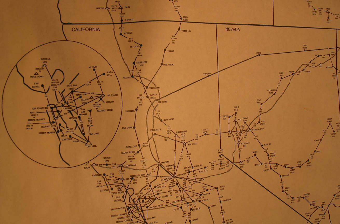
- [M22] 1987: Northern California
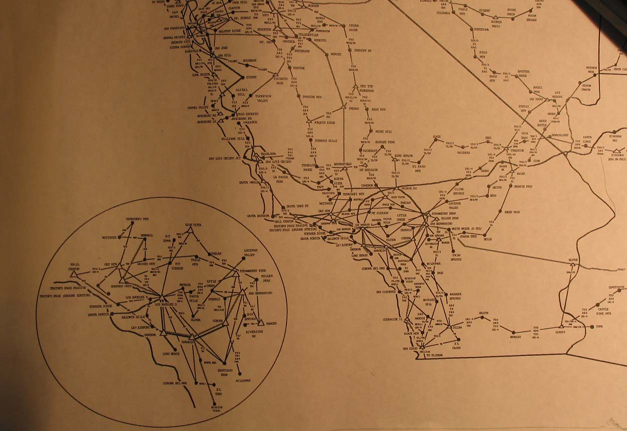
- [M23] 1987: Southern California