This is an old revision of the document!
Maps
Here you will find a collection of historic maps of telephone and telecommunications lines. They are collected from various sources, many of which were already secondhand collections—so a source is noted when possible, but it's hard to be 100% certain where these all came from. The maps are presented by the year they were created and the name shown on the map, when possible. The number in brackets is a TD-2 Control Number, a scheme invented just to make it a little easier to refer to specific maps when they come up in different places online.
Long Lines System Maps
Regional Maps
East Coast
| Year | Map | M# | Authority | Source | Notes |
|---|---|---|---|---|---|
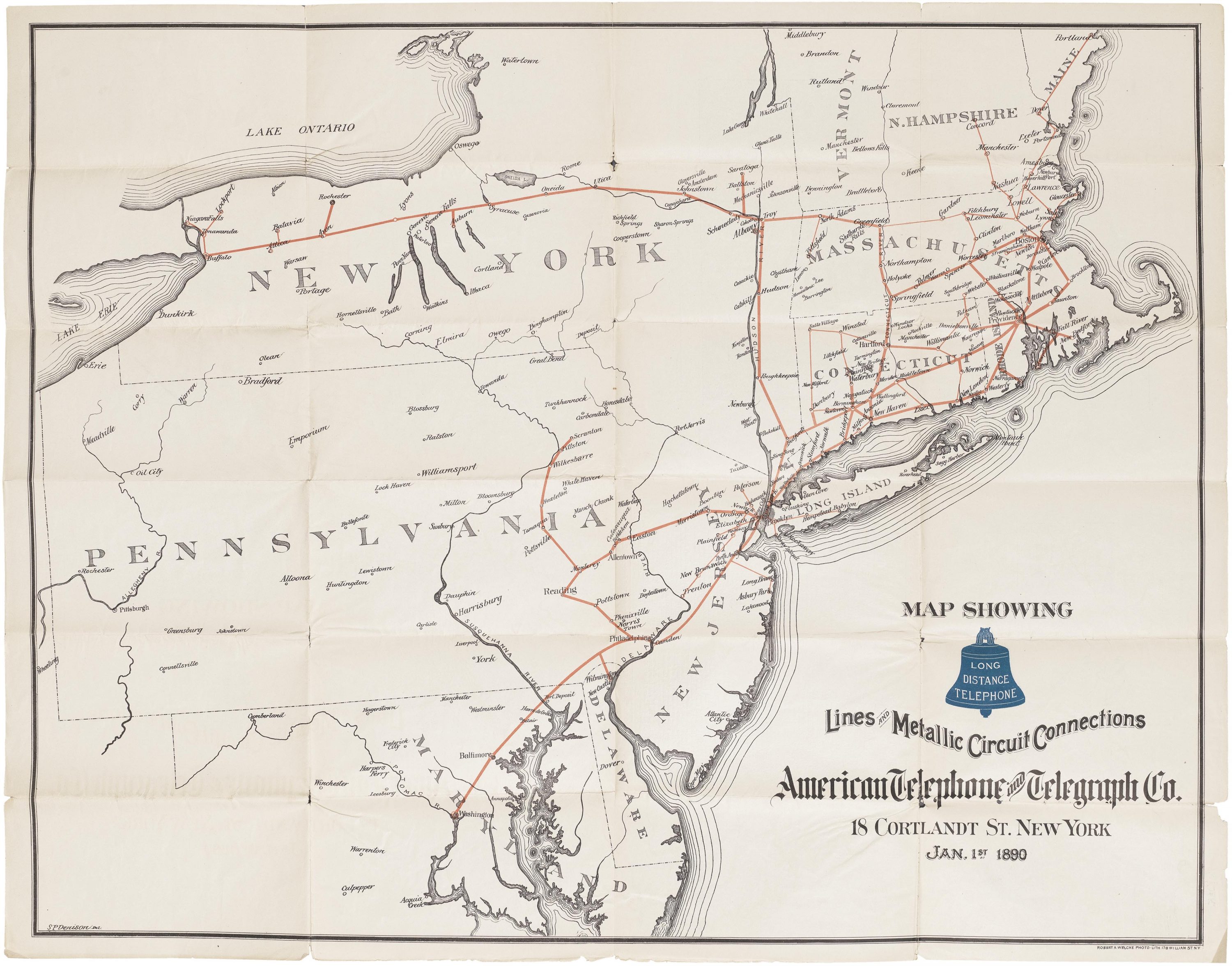
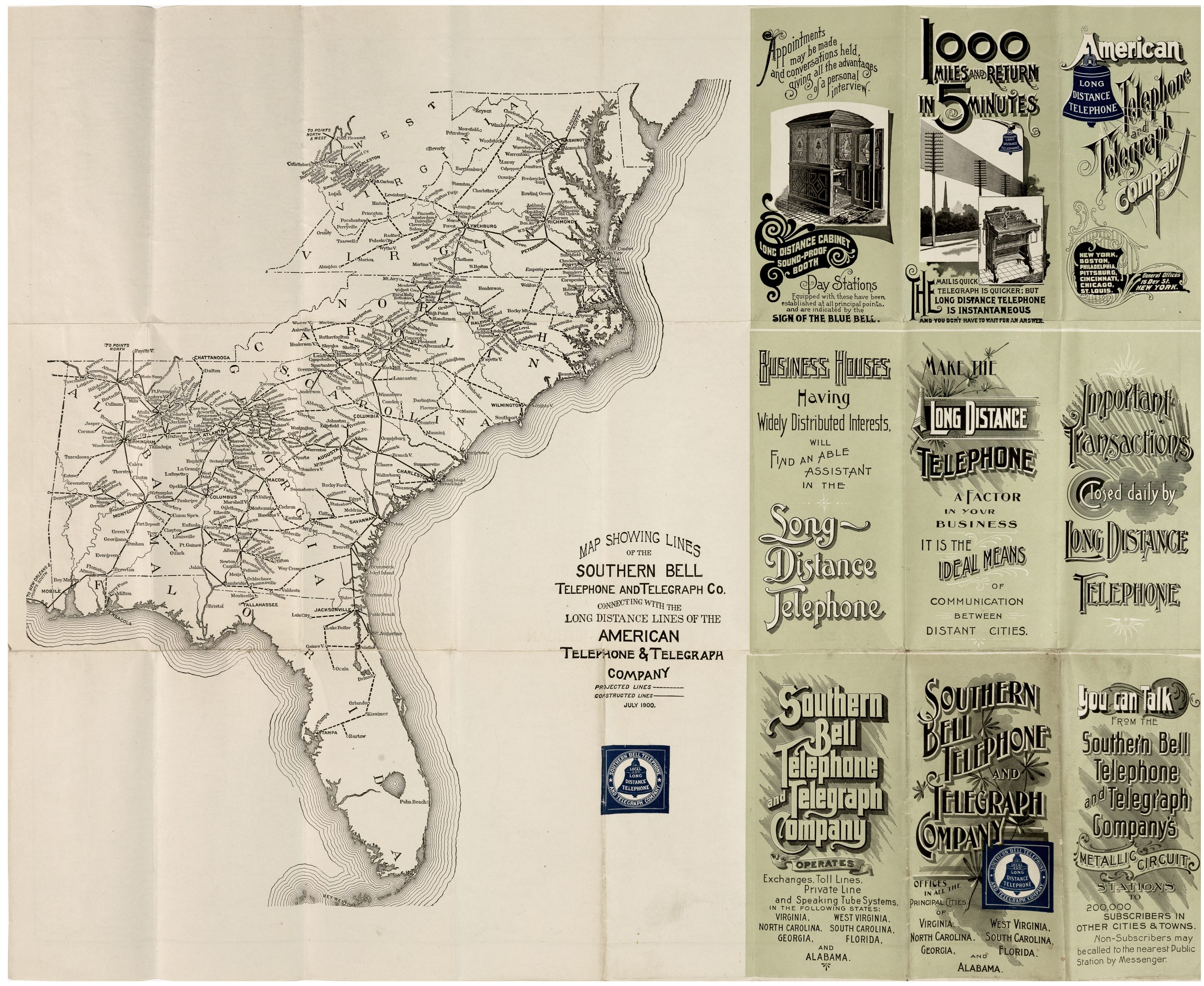
| 1900 | Southern Bell and Interconnecting Long Lines | M21 | Jul. 1900 | ||
| 1969 | Green Hill - Cheshire "A" Cable Route Map | M13 | via WEPBX | Depicts route of the TAT5 transcontinental cable in the coast area |
Mountain States
| Year | Map | M# | Authority | Source | Notes |
|---|---|---|---|---|---|
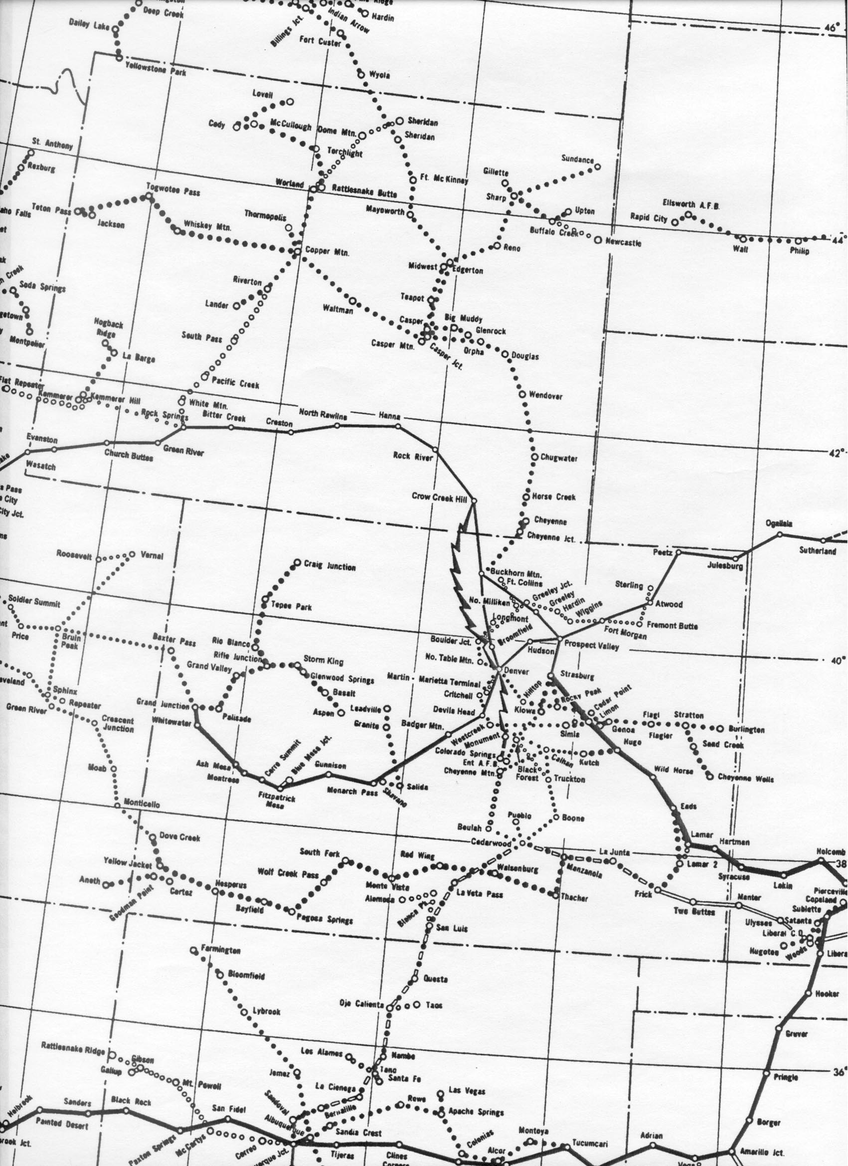
| 1966 | "MW6610-W-1" microwave routes in the Rocky Mountain region | M11 | Via Albert LaFrance/long-lines.net | ||
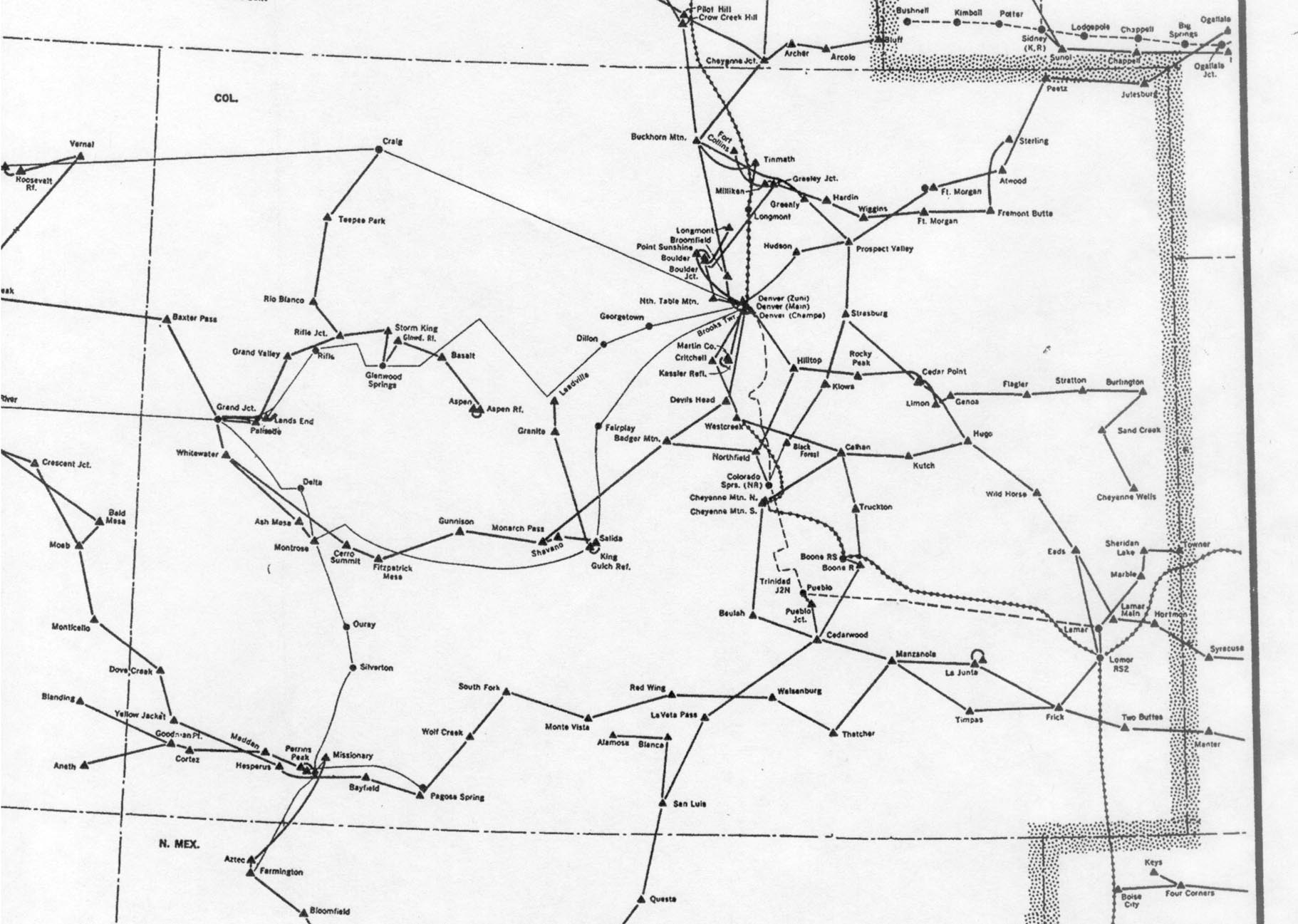
| 1976 | Colorado section of "Routes of American Telephone and Telegraph Company / Western Area" | M12 | Via Albert LaFrance/long-lines.net | ||
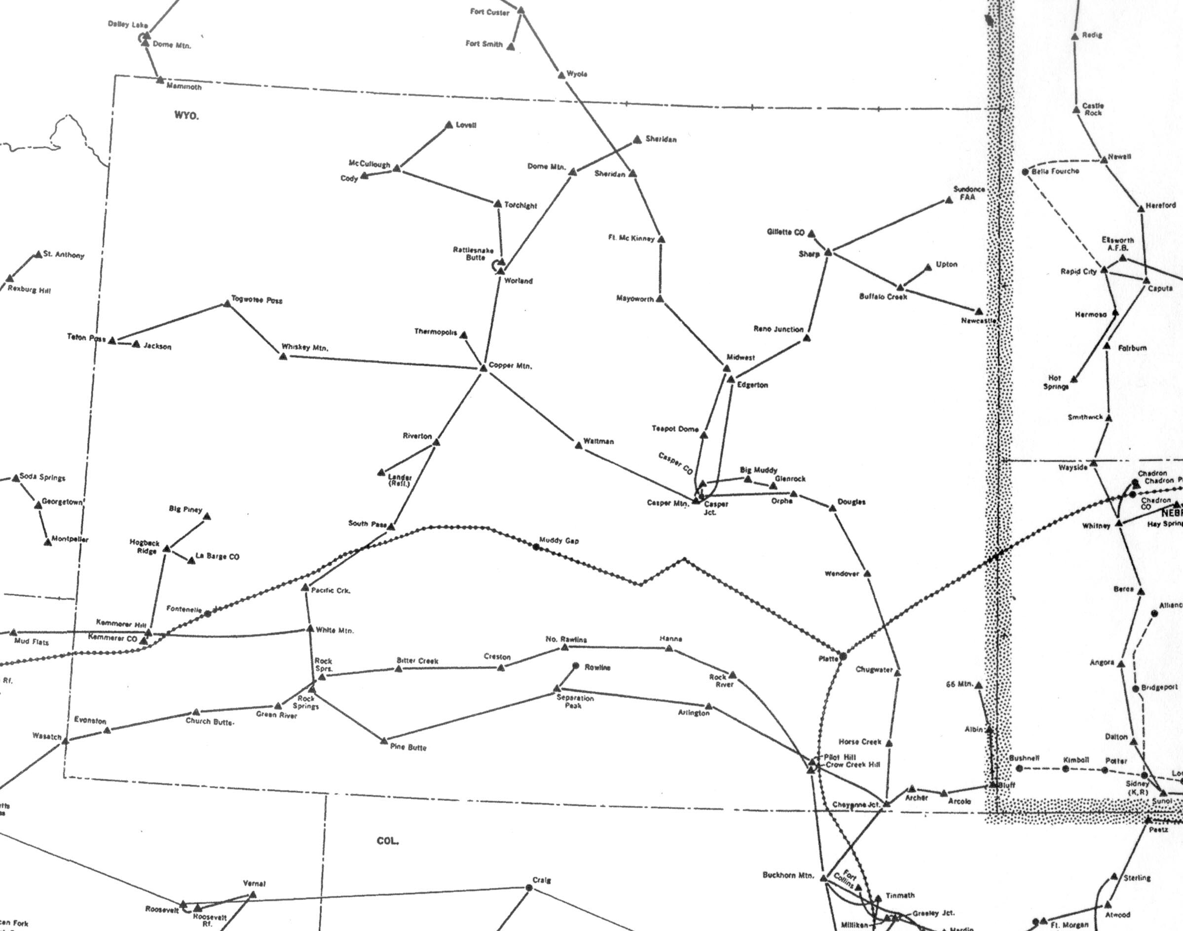
| 1976 | Wyoming microwave map | M24 |
West Coast
| Year | Map | M# | Authority | Source | Notes |
|---|---|---|---|---|---|
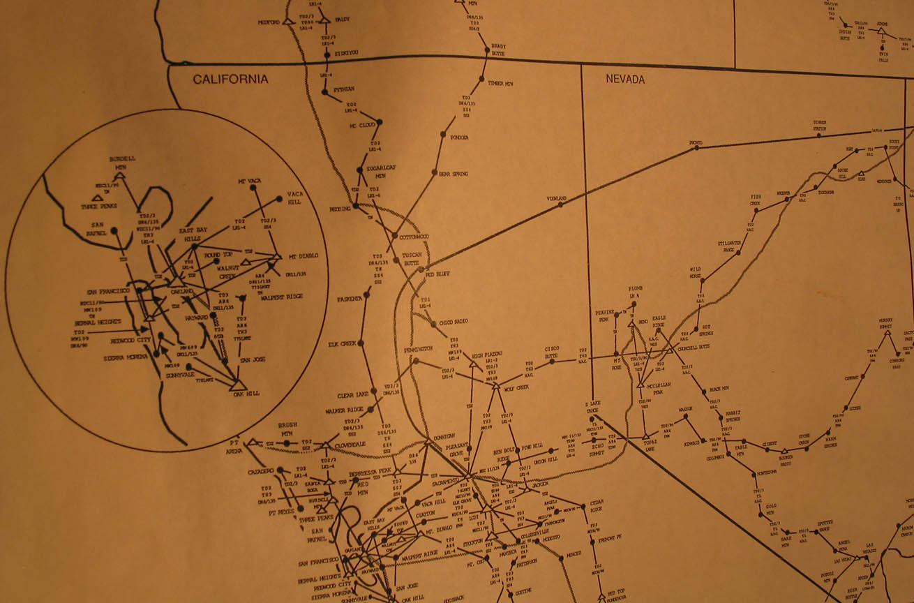
| 1987 | Northern California | M22 | |||
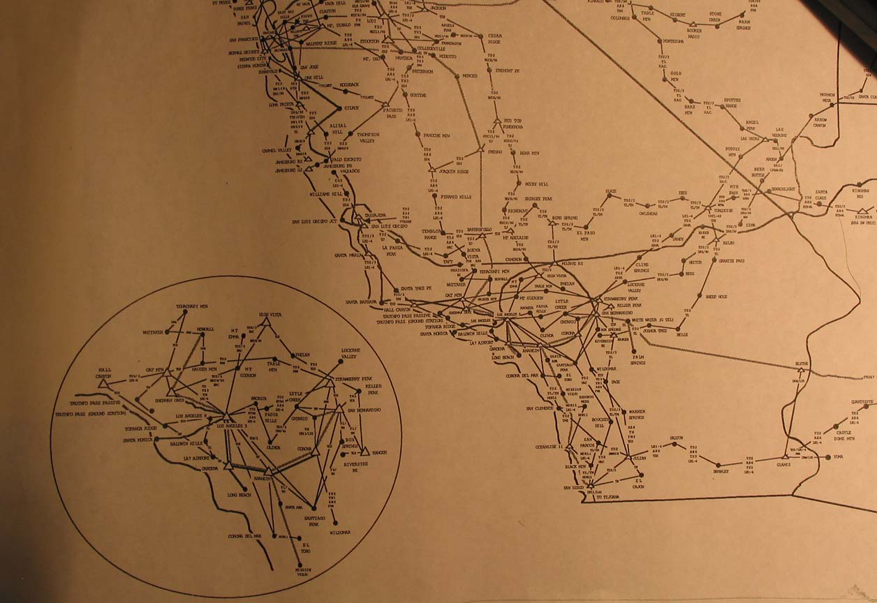
| 1987 | Southern California | M23 |